|

247 MYNYDD MALLÁEN 
GRID REFERENCE: SN 726433
AREA IN HECTARES: 2424.00
Historic Background
An area representing the unenclosed moorland of the Mynydd Malláen plateau,
lying above 300 m. It was formerly divided between the Caeo and Malláen
commotes of Cantref Mawr, which remained an independent Welsh lordship
until 1284 and largely retained native systems of tenure throughout the
Medieval period. As an upland area, land-use was primarily concerned with
the mountain pasturing of animals, and it appears to have been largely
unenclosed during the historic period, as it still is today. It is depicted
as open pasture on the earliest historic maps and is recorded as being
partly common land during the Medieval period. Physical evidence for prehistoric
use of the landscape exists in the form of landmark ritual sites, represented
by Bronze Age round barrows and a possible standing stone, which were
intended to be prominent visual features within the landscape.. A late
Medieval - early Post-Medieval rabbit warren occupied the southern flank
of the plateau, and evidence for limited Post-Medieval enclosure exists
in association with the longhuts characteristic of informal upland settlement
in southwest Wales during this period (Sambrook and Ramsey, 1999). There
are several small former lead and copper mines on the edges of the area,
which may have early origins. Mining was already being undertaken in this
area by the late 13th-century, the crown taking the 'eleventh foot' of
the ore in taxation (Rees 1968), but had largely ceased by the mid 19th-century.
The area has no recent settlement.
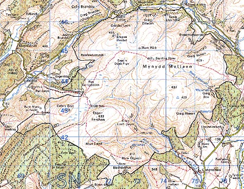
Base map reproduced from the OS map with the permission
of Ordnance Survey on behalf of The Controller of Her Majesty's Stationery
Office, © Crown Copyright 2001.
All rights reserved. Unauthorised reproduction infringes Crown Copyright
and may lead to prosecution or civil proceedings. Licence Number: GD272221
Description and essential historic landscape components
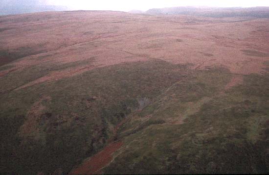
Mynydd Malláen is a high, undulating and isolated plateau which achieves
heights of over 450 m. To the west and north, its very steep and often
craggy sides fall away into the valleys of the Tywi and Cothi. To the
south the edge of the plateau is more broken, but the slopes here are
still steep. Essentially Mynydd Malláen is open moorland - rough grazing,
bracken and blanket peats - with a little improved pasture on the southern
edge. On some steep slopes fringing the plateau there is a little scrubby
woodland, and a small conifer plantation is included in the area. There
are some old earth boundaries on the fringes of the plateau, but occasional
wire fences provide stock-proof boundaries.
Recorded archaeology is relatively rich and comprises Bronze Age round barrows and a possible standing stone, Medieval - Post-Medieval rabbit warrens, longhuts and field system, trackways, lead and copper mines, and unknown earthworks.
There are no standing buildings.
This is a very well-defined area. It is either bordered by farms and fields in valley bottoms, high, semi-enclosed valley sides, or forestry.