|

249 ALLT-Y-HEBOG 
GRID REFERENCE: SN 678436
AREA IN HECTARES: 272.70
Historic Background
A small area of modern coniferous forest in the foothills of the Cambrian
Mountains. It once lay within the former Cwmwd Caeo, specifically Maenor
rhwng Twrch a Chothi, of Cantref Mawr which remained an independent Welsh
lordship until 1284 and largely retained native systems of tenure throughout
the Medieval period. It is an upland area, but has probably always been
subject to fairly intensive land-use and is enclosed with two distinct
field patterns. To the west, an east-facing hillslope, Troed-y-rhiw, and
the valley of the Nant y garth exhibit a pattern of small, rectilinear
enclosures, some of which are long and narrow suggesting the enclosure
of former strip-fields, perhaps a manorial infield. To the east, the hills
Allt Bryn-têg and Allt-yr-hebog are enclosed with very large, regular
rectangular fields which are late in origin, having been established since
the tithe survey of 1840 (Cynwyl Gaeo parish). There are a number of abandoned
early dwellings/farmsteads, including the interestingly-named Erw-hen
and Erw-newydd. The area has no recent settlement and now lies entirely
beneath late 20th-century coniferous plantation.
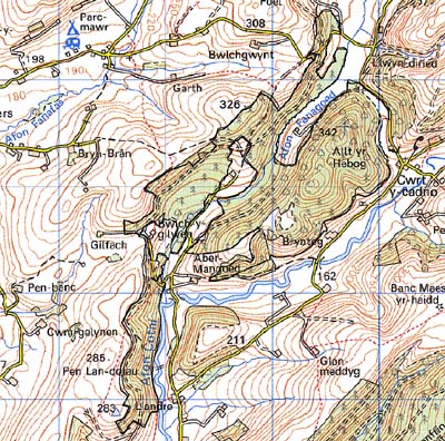
Base map reproduced from the OS map with the permission
of Ordnance Survey on behalf of The Controller of Her Majesty's Stationery
Office, © Crown Copyright 2001.
All rights reserved. Unauthorised reproduction infringes Crown Copyright
and may lead to prosecution or civil proceedings. Licence Number: GD272221
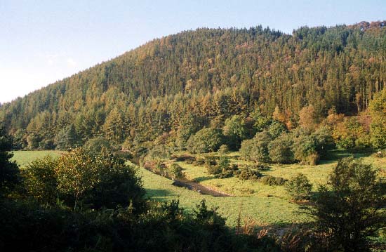
Description and essential historic landscape components
This character area comprises woodland on steep slopes of the Upper Cothi
valley. It lies between approximately 180 m and 340 m. The woodland consists
of ancient deciduous woods interspersed with which are large conifer plantations.
Most of the plantations seem to have been established in what was once
open land, though small areas had been enclosed into small fields. A small
surviving pocket of dispersed trees, small clumps of trees, and rough
grazing on steep craggy slopes, give an impression of the appearance of
much of the landscape prior to afforestation. It is possible that this
pre-afforestation landscape was established by the Dolaucothi estate.
The main components of the historic landscape now comprise plantations
and their associated tracks and drives.
Recorded archaeology is limited to abandoned farms and cottages, and a Roman coin hoard.
There are few buildings and none of them are distinctive.
This area is well-defined to the south and west by farms and fields in the valley bottom. Elsewhere character areas have yet to be defined.