Home > Historic Landscape Characterisation > Carmarthen Bay Estuary Area > |

 THE HUGDEN
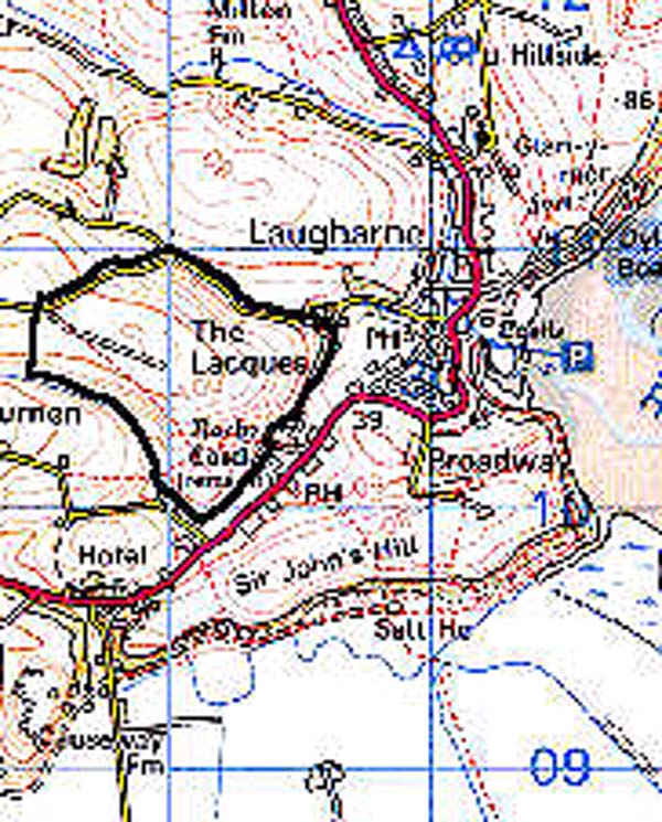
GRID REFERENCE: SN 290104
AREA IN HECTARES: 66.86
Historic Background
An area of land that was held under manorial tenure of the Medieval Lordship of Laugharne. In 1278-82 Sir Guy de Brian, Lord of Laugharne, granted certain lands, including 'The Hugden', to the burgesses of Laugharne (Williams, n.d.). The burgesses farmed The Hugden using a strip- or open-field system. This system of farming has continued to the present day and has been described by Davies (1955). Strips of land would have been allotted on an annual basis to the burgesses of Laugharne and Llansadurnen, but by 1842 this practice had ceased and strips had been amalgamated into 20 shares which each burgess held for life. One shilling is paid annually to Laugharne Corporation per share; one share averages 7-9 acres and is made up of 5-12 strips. Contained within each share is one major strip that lies across the crest of The Hugden and several subsidiary strips on lower, sometimes steep, slopes. Strips are divided by earth baulks called landscars or landskers. Since 1842 a hedge has been established dividing the major shares in two.
Base map reproduced from the OS map with the permission
of Ordnance Survey on behalf of The Controller of Her Majesty's Stationery
Office, © Crown Copyright 2001.
All rights reserved. Unauthorised reproduction infringes Crown Copyright
and may lead to prosecution or civil proceedings. Licence Number: GD272221
 Description and essential historic landscape components
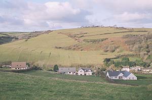
The Hugden is essentially an unenclosed rounded hill over which a system of open field farming is practised. The hill rises from 50m on its southern flanks to over 110 m at its highest point. In the past arable farming was undertaken. Several years ago some of the strips in the system were ploughed, but none were noted under this form of cultivation in 1999. The strips are now used for hay and the over-wintering of cattle. The longest and widest strips within the field lie over the crest of the hill; these are poorly marked on the ground. Lesser strips which lie on the flanks of the hill are better defined and earth baulks between strips are clearly visible, particularly where they run down steep slopes or across slopes. In the latter instance they form lynchets over 1m high which in some instances are covered with scrub or gorse. Some of the less-favoured strips have been abandoned and have reverted to scrub and bracken. A single 19th century hedge on a low bank lies across the crest of the hill, but The Hugden is separated from the neighbouring enclosed farmland by further hedges on banks which belong to the surrounding historic landscape area. There are no wooded areas.
Recorded archaeology is limited to agricultural features.
There are no buildings.
This open field system is a distinct and clearly defined historic landscape area. It is surrounded by enclosed land.