Home > Historic Landscape Characterisation > Carmarthen Bay Estuary Area > |

 PENYBEDD WOOD
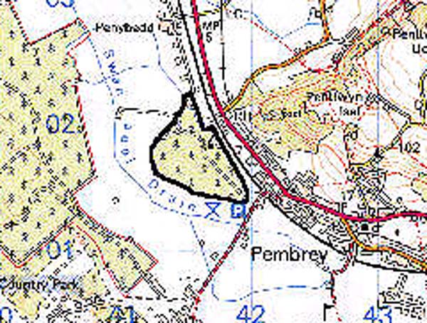
GRID REFERENCE: SN 415017
AREA IN HECTARES: 33.73
Historic Background
For the general landscape history of Penybedd Wood see the neighbouring landscape areas. Penybedd Wood may represent the core of the tongue of dry land at the foot of Mynydd Penbre around which reclamation occurred from the 17th century onwards, but does not appear to have formed part of the Medieval and Post-Medieval Manor of Caldicot (James 1991, 153). The Pembrey tithe map of 1841 and the Ordnance Survey 6" first edition of 1891 show the area as a small patch of unenclosed land. It was planted with conifers after the Second World War.
Base map reproduced from the OS map with the permission
of Ordnance Survey on behalf of The Controller of Her Majesty's Stationery
Office, © Crown Copyright 2001.
All rights reserved. Unauthorised reproduction infringes Crown Copyright
and may lead to prosecution or civil proceedings. Licence Number: GD272221
 Description and essential historic landscape components
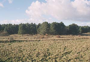
This very small historic landscape character area comprises a post-Second World War coniferous plantation. The land lies barely above sea level, and unlike the surrounding areas it does not consist of reclaimed marsh, but of low sand dunes. Areas of wind-blown sand have a very limited economic use, therefore it was not subject to enclosure in the historic period, and caused it to be planted for forestry. A small picnic site has been established in the forestry.
There is no recorded archaeology within the area.
There are no buildings.
This is a distinct historic landscape area with clear boundaries with neighbouring areas which consist of enclosed former marsh, or residential development.