Home > Historic Landscape Characterisation > Carmarthen Bay Estuary Area > |

 KIDWELLY BURROWS

GRID REFERENCE: SN 401064
AREA IN HECTARES: 129.30
Historic Background
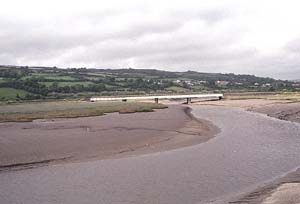
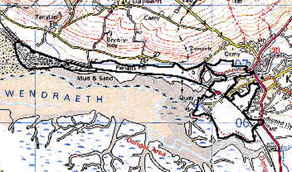
An area of marsh and sand-hills on the north side of the Gwendraeth Estuary. Its history is linked with that of the borough of Kidwelly, and the foreignry of St Ishmael within which the western half of the area is situated, and it was particularly affected by Kidwelly's industrialisation during the later 18th- and 19th-century. In 1766-8 Thomas Kymer established a quay on the south side of the Gwendraeth Fach estuary, and a canal (later a railway, now gone) to convey coal from his mines in the Trimsaran/Pontiets area, and in 1852 the GWR West Wales main line was taken through the area (Ludlow 1999, 28). A brickworks and a silica works, now gone, were established next to the railway lines in the later 19th century. There has been little recent permanent development; tourism and leisure are now the main activities and the western half of the area has, since the 1970s, been occupied by a large caravan and chalet park, while Kymer's canal and quay were restored under the Manpower Services Commission in the 1980s.
Base map reproduced from the OS map with the permission
of Ordnance Survey on behalf of The Controller of Her Majesty's Stationery
Office, © Crown Copyright 2001.
All rights reserved. Unauthorised reproduction infringes Crown Copyright
and may lead to prosecution or civil proceedings. Licence Number: GD272221
 Description and essential historic landscape components
An area of marsh and sand-hills lying between just above sea level and 10 m, which probably has early rather than later origins, the trend on the northward side of the Gwendraeth Estuary being for erosion rather than deposition. A more stable environment permitted the construction, in 1766-8, of Thomas Kymer's Canal and. in 1852, of the GWR main line. The 'Dinas' brickworks and silica works formerly lay either side of the railway line (Ordnance Survey 6" First Edition, Sheet LIII. NW, 1891). There are 19th- and 20th-century sea-defences to the south of the area. The area is, by and large, enclosed with straight boundaries represented by hedges which are becoming overgrown.
Recorded archaeology in the area consists only of those features noted above ie. Kymer's quay and canal, the railways, the former brick- and silica works, and the sea-defences. Kymer's quay has been restored and there are some associated stone buildings, now derelict.
There are no distinctive buildings.
This is a distinct historic landscape area of sand hills and marsh, lying between unenclosed muddy saltmarsh and the rising, bank-enclosed ground to the north.