|

190 LLANFIHANGEL ABERBYTHYCH 

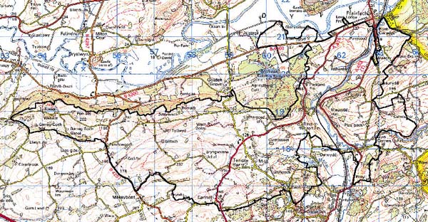
GRID REFERENCE: SN 585189
AREA IN HECTARES: 2294.00
Historic Background
A very large character area bisected by the valley of the Afon Cennen. It occupies the central part of Iscennen commote which, unlike the rest of Cantref Bychan within which it lay, remained nominally independent of Anglo-Norman rule until 1284 when it was acquired by John Giffard. In 1340 it became a member of the Duchy of Lancaster (Rees 1953, xv-xvi). The nature of this tenure may be reflected in the pattern of small- and medium-sized irregular fields which characterise the area, and may be late Medieval in origin, like similar fields in Area 185 towards the west end of the Tywi Valley which appear to pre-date the late 16th-century enclosure of their margins. Evidence for ridge and furrow cultivation, however, has been recorded in the western part of Area 190. The present pattern of enclosures and farms had nevertheless evolved by at least the early 19th-century, and is depicted as such on the tithe maps of Llanfihangel Aberbythych (1837) and Llanarthne (1848) parishes, though all early settlement is shown as dispersed. Possible ecclesiastical land lies to the west of the area and the origins of Talhardd, a farmstead on the low-lying ground on the west side of the Cennen, are said to be as a 13th century grange of the Premonstratensians at Talley (Rees 1932). However, it is not listed among the former possessions of the abbey in an early 17th-century rental (Owen 1894, 92) which may have been compiled after it had spilt from the estate. The present house is sub-Medieval but a nearby maerdy place-name, derived from a reeve or maer, may be associated with a monastic holding or the Tregîb estate in Area 203 (Sambrook and Page 1995, 17). The only other early gentry house is Derwydd, to the south-east of the area, an important holding which was referred to in 1550 as the home of Rhydderch ap Hywel ap Bedo (Jones 1987, 55), with a garden remodelled in 1889 (Whittle 1999). Cellifor to the west is at least late 17th-century (Jones 1987, 29), now rebuilt, while Caeglas and Cefncethin to the east were established in the late 18th-century (Jones 1987, 20, 27), though none of the latter houses were associated with large estates. A railway was constructed along the Cennen Valley between Ammanford and Llandeilo in 1841 by the GWR, but 19th- and 20th-century development has been limited. Although there was some limestone extraction in the area, immediately beyond to the southeast intensive extraction was undertaken from the 19th century onwards giving rise to a number of settlements. These are concentrated on the fringe of the area, which also features new concentrations at Carmel, Milo and Pant-y-llyn.
Base map reproduced from the OS map with the permission
of Ordnance Survey on behalf of The Controller of Her Majesty's Stationery
Office, © Crown Copyright 2001.
All rights reserved. Unauthorised reproduction infringes Crown Copyright
and may lead to prosecution or civil proceedings. Licence Number: GD272221
Description and essential historic landscape components
Llanfihangel Aberbythych character area rises from the Tywi valley on its northern edge at 20 m above sea level to over 250 m on its southern boundary. It includes the lower valley of the Cennen and the Marlais valley. It essentially consists of land that is entirely enclosed by small- and medium-sized irregular fields with a settlement pattern of dispersed farms. Land-use is almost entirely pasture, with a little arable. The pasture is mostly improved, though there is rougher and rushy ground in the Temple Bar/Milo area. There are numerous small stands of deciduous woodland, particularly on steep valley sides, some of which may be ancient. Field boundaries are of earth banks topped with hedges, and may be late Medieval in origin. Hedges are generally in good condition, though there is evidence of some neglect and dereliction at higher levels. Occasionally hedges are overgrown, and a few possess distinctive trees. At lower levels towards the Tywi valley farms tend to be larger than on higher ground. Superimposed over the ancient settlement pattern of dispersed farms are 19th- and 20th-century villages and hamlets, linear development and dispersed dwellings. Both Milo and Carmel villages have 19th century cores consisting of stone-built dwellings and chapels, but both have late 20th-century additions in the form of dwellings in a variety of styles and materials. Pant-y-llyn is a 19th century row of workers cottages built to serve limestone quarries close by. Dispersed and linear 19th- and 20th-century residential development is mostly strung along the A476 and A483(T) roads, with concentrations close to Llandeilo and at Derwydd.
Recorded archaeology is of relatively low density and low diversity. A group of Bronze Age burnt mounds lie near the Cennen, and there are possible round barrow and standing stone sites. There are two Iron Age hillforts. A Roman road south of Llandeilo may be preserved in the line of field boundaries. There is an inscribed stone in the eastern part of the area, which appears to relate to the pre-Conquest church at Llandeilo Fawr (Area 202), and possible holy wells and crosses are recorded as place-names. Post-Medieval features include quarries, lime-kilns and possible kilns to the south of the area, bridges, a mill, a possible smithy, a possible pound or fold, and cottages. The railway opened by the GWR in 1841 is still operational and a dominant feature of the landscape.
There are some distinctive buildings. Talhardd farmhouse, which is Grade II listed, is largely sub-Medieval, probably of 16th century date, with 17th century fittings and late-Georgian remodelling; it was once thought to have been moated. Derwydd is Grade II* listed and incorporates an early 16th century house and possibly also the remains of a 15th century house. It contained 18 hearths in 1670 and was thus among the largest in Carmarthenshire at the time (Jones 1987, 55). House and garden are entered as ref. number PGW (Dy) 6 (CAM) in the Cadw/ICOMOS Register of Parks and Gardens of Special Historic Interest in Wales (Whittle, 1999). The far west end of the area is dominated by Paxton's Tower, a Grade II listed folly erected on an outlying part of the Middleton estate in c.1807-10, and there are two Middleton lodges. Farms lying at lower levels towards the Tywi valley tend to be larger than those on higher ground, and their respective buildings are of a higher quality, often with three-storey 18th- and 19th-century dwellings in the Georgian tradition. The stone-built buildings on the larger farms, which are mostly 19th century, are also larger and often arranged in a formal basis around a yard. However, the predominant farmhouse style is the stone-built, slate-roofed dwelling of two storeys and three bays in the vernacular rather than the polite tradition. The masonry, mostly 19th century farm buildings on these smaller holdings tend to smaller and less formally arranged, often consisting of just one range. Most farms have large modern farm buildings associated with them. There are a number of 19th century chapels.
This character area is fairly well defined along its northern edge and against the town of Llandeilo. To the south character areas have yet to be defined, but there is at least in part a clear border between this area and a limestone ridge. To the east there is no clear definition between this area and its neighbours, as all possess similar historic landscape components, but rather a zone of change.