Home > Historic Landscape Characterisation > Milford Haven Area > |

GULF OIL REFINERY 
GRID REFERENCE: SM 933052
AREA IN HECTARES: 199
Historic Background
Apart from a very narrow strip of land comprising sea cliffs and cliff
top, this historic landscape character area is entirely taken up by an
oil refinery and a small industrial estate. Prior to construction of the
oil refinery this was an agricultural landscape, almost entirely lying
within Llanstadwell parish. It occupied the medieval manor of Waterston,
which was a ‘mesne’ lordship of the Lordship of Haverford.
On the tithe map of 1849 a very distinct landscape of enclosed strip fields
surrounded Waterston village, including the area to the south of the village
now occupied by the refinery. These strip fields were clearly the enclosed
remnants of the open fields of Waterston manor and township. Later maps
show the strip fields, but during the later 19th century and the 20th
century some had been merged into larger, squarer enclosures. Elsewhere
the pre refinery landscape comprised regularly-shaped fields associated
with Newton Farm – labelled Newton Demesne on the tithe map. These
fields and farm no longer exist. Construction began on the Gulf refinery
in 1966, and the first tanker unloaded crude oil in 1968.

Base map reproduced from the OS map with the permission
of Ordnance Survey on behalf of The Controller of Her Majesty's Stationery
Office, © Crown Copyright 2001.
All rights reserved. Unauthorised reproduction infringes Crown Copyright
and may lead to prosecution or civil proceedings. Licence Number: GD272221
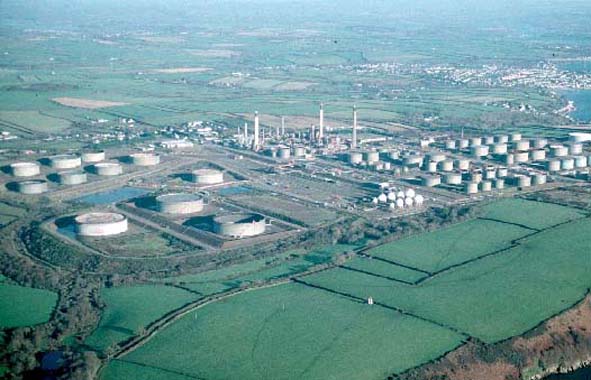
Description and essential historic landscape components
This historic landscape area comprises a late 20th century oil refinery.
It includes all the installations, including jetties for the unloading
of crude oil and a mainline railway. Also included in this area is a small
industrial estate. A short section of sea cliff and cliff top between
the refinery and the sea is the only component of the landscape not built
upon.
This is a very distinct area with clear boundaries. It stands in sharp contrast to the surrounding farms and villages.
Sources: McKay 1993; Llanstadwell Parish Tithe Map, 1849; Ordnance Survey
6” to 1 mile 1st Ed. XXXIII, XXXIX, 1874; Richards 1969