Home > Historic Landscape Characterisation > Milford Haven Area > |

MULLOCK BRIDGE 
GRID REFERENCE: SM 812081
AREA IN HECTARES: 88
Historic Background
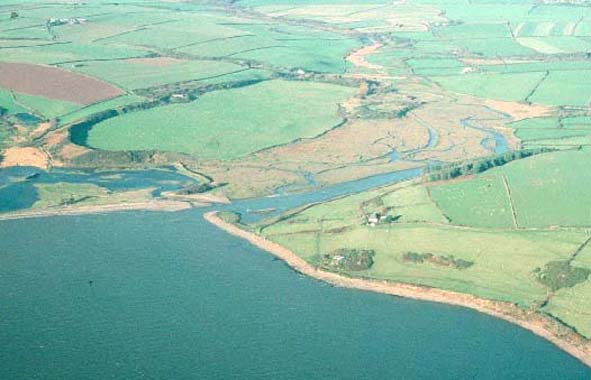
This is a relatively small historic landscape character area consisting
of salt marsh, tidal mud flats and low-lying land subject to flooding,
either side of a small inlet at the mouth of a stream. It lies within
Marloes parish. The area belonged to the ½ knight’s fee that
was held of the Lordship of Pembroke by the de Vale family, Lords of Dale,
from at least 1247, as the Manor of Mullock and Bicton. A tenament known
as Crabhall, which extends into the west of the area, was held by the
sub-tenant Philip Crabhole in the late 14th century and eventually passed
to the Wogans of Boulston. An early 19th century estate map labels this
area ‘Pickle Ridge and Cran Marsh’ and shows it as gravel
and mud with a road titled ‘summer’s Boat Road’ running
up its western side. The map shows an embankment across the mouth of the
estuary – an early attempt to drain the area. Later maps show other
embankments along the eastern and western side of the watercourse. Part
of this area was subjected to gravel quarrying from the 1950s to the 1980s.
It may have been within this inlet that Henry Tudor (Henry VII) landed
in 1485, on his way to Bosworth Field. By tradition it was under Mullock
Bridge, which crosses the inlet towards the middle of the area, that Rhys
ap Thomas hid in 1485 to fulfil his promise that Henry Tudor would only
get the crown by marching over his body.
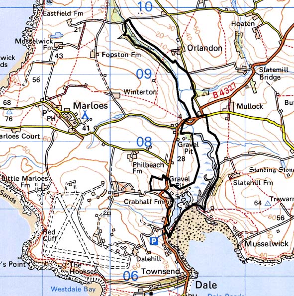
Base map reproduced from the OS map with the permission
of Ordnance Survey on behalf of The Controller of Her Majesty's Stationery
Office, © Crown Copyright 2001.
All rights reserved. Unauthorised reproduction infringes Crown Copyright
and may lead to prosecution or civil proceedings. Licence Number: GD272221
Description and essential historic landscape components
This area lies across the valley floor of a small inlet that is tidal
downstream of Mullock Bridge. Here marsh and salt marsh predominates with
mud and gravel on the foreshore. Water-filled old gravel pits lie towards
the estuary mouth. Marsh lies immediately upstream of the bridge with
scrubby woodland further upstream. Old embankments both upstream and downstream
of the bridge testify to former attempts to drain the marsh. These embankments
are now breached. The Pembrokeshire Coast Path runs across the mouth of
this inlet. Apart from the single arched stone-built 18th century or 19th
century Mullock Bridge, which is Grade II listed, and a modern bridge
alongside it there are no structures in this area. Archaeology consists
of reports of burials close to the bridge and a mill site.
This is a well-defined historic landscape area below Mullock Bridge, with the marsh standing in sharp contrast with the surrounding farmland. Further upstream the distinction between this area and its neighbours is blurred, but still present.
Sources: Jones 1996; Ludlow in Crane, forthcoming; Marloes Parish Tithe
Map 1843; Ordnance Survey 6” to 1 mile 1st Ed. XXXII, 1887; PRO
HDX/80/66; Walker 1950