Base maps reproduced from the OS map with the
permission of Ordnance Survey on behalf of The Controller of Her Majesty's
Stationery Office, © Crown Copyright 2001. All rights reserved. Unauthorised
reproduction infringes Crown Copyright and may ead to prosecution or civil
proceedings. Licence Number: GD272221
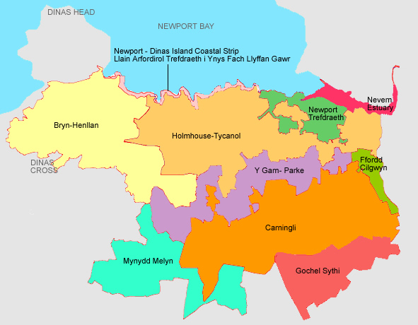
Carningli
is a historic landscape character area of open moorland
crossed by occasional old boundary banks and walls. Carningli hillfort
dominates this landscape, and there are numerous smaller related
monuments as well as bronze age burial mounds and other ritual and
funerary monuments. |
|
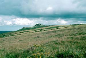
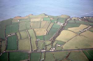
Lying
on the north-facing slopes below Mynydd Carningli, Y Garn
– Parke is characterised by a relatively dense scatter
of cottages, houses and small agricultural holdings set within small
fields bounded by stone-faced banks and dry-stone walls. At higher
levels pasture is reverting to moorland. |
|
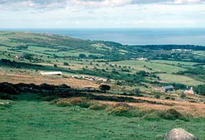
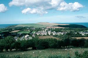
Lying
on the southern shore of the Nevern estuary, the small town of Newport
is strongly characterised by numerous stone-built 19th
century houses. It is an Anglo-Norman foundation, and the medieval
church and medieval castle are still strong townscape components. |
|
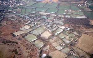
Holmhouse
– Tycanol is an agricultural historic landscape character
area consisting of relatively large farms set within large, regular
fields bounded by stone-faced banks topped with well maintained
hedges. Buildings are stone-built and mainly 19th century in date. |
|
Lying
on the north Pembrokeshire coastal plain, Bryn-henllan
historic landscape character area is a combination of hamlets, small
farms and fields. The hamlets of 19th century stone-built houses
are now connected by modern housing development. Farms are relatively
small, and fields are small and irregular and bounded by banks topped
with hedges. |
|
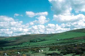
Mynydd
Melyn is a small upland historic landscape character area
that in the past has been divided into large enclosures by stone-faced
banks and dry-stone walls, although these are now redundant and
wire fences provide stock proof boundaries. Land-use is a mixture
of improved pasture and heather moorland. |
|
Newport
to Dinas Island Coastal Strip consists of high, hard rock
sea cliffs and a very narrow band of cliff top through which the
Pembrokeshire Coast Path runs. Old quarries testify to the fomer
importance of slate extraction. |
|
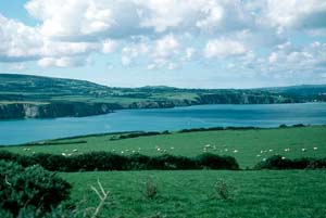
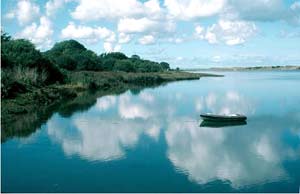
Consisting
of tidal mud flats, reed beds, marsh and scrubby woodland edging
the water, the Nevern Estuary historic landscape
character area contains few built elements apart from Newport Bridge,
an old limekiln and the Pembrokeshire Coast Path. |
|
Ffordd
Cilgwyn historic landscape character area consists of small
farms and houses. Buildings are almost entirely 19th century in
date and stone-built. Fields are small and regular and are surrounded
by stone-faced banks topped with hedges. |
|