Base maps reproduced from the OS map with the
permission of Ordnance Survey on behalf of The Controller of Her Majesty's
Stationery Office, © Crown Copyright 2001. All rights reserved. Unauthorised
reproduction infringes Crown Copyright and may ead to prosecution or civil
proceedings. Licence Number: GD272221
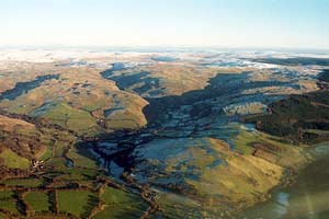
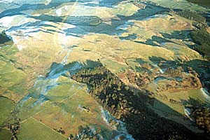
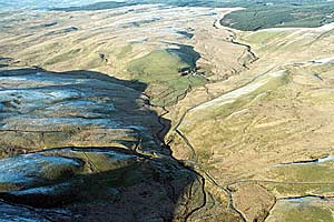
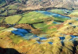
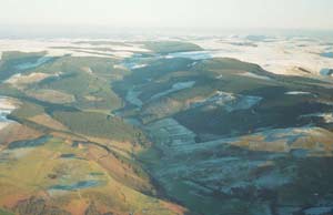
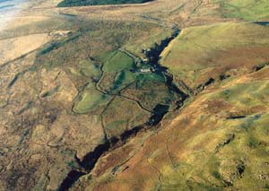
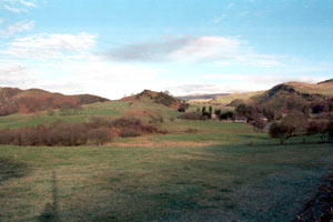
Afon Mwyro
A few farms dispersed along the valley floor and lower valley sides,
stone- and earth-banks of small fields and a little woodland characterise
the landscape of the upland valley of the Afon Mwyro. |
|
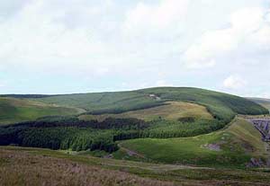
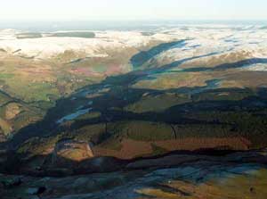
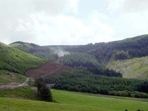
Banc
Creignant Mawr
Banc Creignant Mawr is an upland forestry plantation dating to
the 1960s. The plantation was established over open moorland. |
|
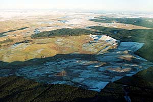
Banc
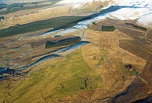
Esgair Mwn & Rhos Tanchwarel
Banc Esgair-mwn and Rhos Tanchwarel historic landscape character
area consists of old enclosed land and settlements of cottages and
smallholdings, many of which are abandoned. Land-use is a mixture
of improved grazing and rougher ground. The remains of the lead
mining industry are a prominent landscape feature. |
|
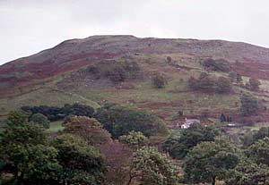
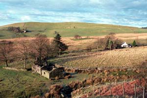
Berthgoed
Abandoned smallholdings/cottages and deserted fields in a landscape
of moorland with regenerating woodland on steep slopes characterise
the Berthgoed historic landscape. |
|
Blaen
Glasffrwd
A 20th century coniferous plantation surrounds Blaen-Glasffrwd
- a pocket of upland improved pasture, rough grazing and a single
farm. |
|
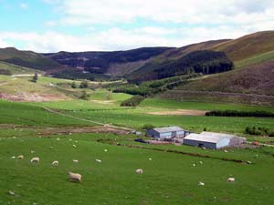
Brignant
Upland rough grazing and peaty hollows with improved grazing on
lower-lying flanks, and small coniferous plantations are the main
components of the Brignant landscape. Abandoned farms and cottages
and the remains of lead mines testify to a once much more actively
populated landscape. |
|
Bryngwyn
Bryn Gwyn comprises an upland coniferous plantation established
in the 1960s over unenclosed moorland. |
|
Bryngwyn
Bach
Bryngwyn Bach is a large tract of upland characterised by open
moorland and occasional farms. Abandoned farms and cottages and
Bronze Age funerary and ritual monuments illustrate that this landscape
was once more actively exploited in the near and distant past. |
|
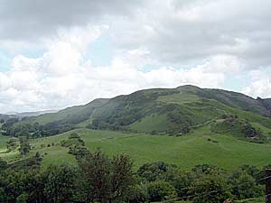
Bryn
Tyn- Llwyn
Fields of improved grazing within a small area of craggy, steep
slopes characterise the Bryn Tyn-Llwyn landscape. There are several
deserted settlements, but no inhabited dwellings. |
|
Cambrian
Mountains
The Cambrian Mountains historic landscape character area is the
largest in upland Ceredigion and comprises high, open moorland with
occasional dispersed farms. Abandoned farms and cottages and Bronze
Age round barrows and related monuments attest to greater exploitation
of the area in the past. |
|
Coed
Bwlchwallter
Large-scale 20th century coniferous plantations established over
open moorland are the main components of the Coed Bwlchgwallter
historic landscape character area. |
|
Cyneiniog
A single farm, small fields, deciduous woodland and a modern coniferous
plantation are the main components of the Cyneiniog historic landscape
character area. |
|
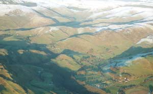
Cwm
Mynach
Cwm Mynach historic landscape character area lies across the floor
and spreads up the lower valley sides of a steep-sided upland valley.
Hedges of the small, irregular fields, and stands of deciduous trees,
lend a wooded aspect to the landscape. The settlement pattern is
of dispersed, upland farms. |
|
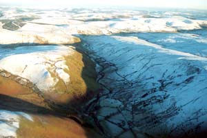
Cwmystwyth
Cwmystwyth is an old industrial landscape. The remains of metal
mining are spread across the floor and sides of the steep-sided,
craggy valley of the Ystwyth. |
|
Dyffryn
Castell
Farms dispersed along the lower slopes of an upland valley, the
remains of 19th century metal mines, large fields of improved pasture
and rough grazing, and the sinuous route of the A44 turnpike are
all components of the Dyffryn Castell historic landscape character
area. |
|
Disgwylfa
Disgwylfa is an upland historic landscape area comprising moorland
on which are found the remains of 18th and 19th century metal mines,
deserted cottages and smallholdings and Bronze Age funerary and
ritual monuments. |
|
Esgair
Fraith
Esgair Fraith is a very extensive tract of upland 20th century
coniferous plantation. It was established over unenclosed moorland.
Remains of metal mines and deserted settlements lie in the plantation. |
|
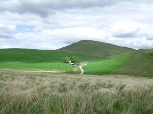
Frongoch
Frongoch is an upland farm set in pocket of small- to medium-sized
fields of improved pasture on the edge of open moorland. |
|
Fuches
Wen
Unenclosed moorland is the defining characteristic of the Fuches
Wen historic landscape character area. Deserted settlements of the
historic period and Bronze Age funerary and ritual monuments testify
to a once more settled and more intensively exploited landscape
in the past. |
|
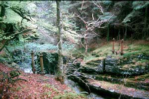
Hafod
Hafod is celebrated for its picturesque qualities; Thomas Johnes
exploited these in the late 18th and early 19th century. His mansion
no longer exists, but some of his buildings survive, as do many
of the walks he established. Most of the estate is now under coniferous
plantations established in the 1950s and 1960s. |
|
Lluest
The settlement pattern of Lluest originated in the late 18th and
early 19th centuries, during which time squatters built cottages
and smallholdings on high common land. Many of these settlements
have been abandoned, and those that survive are often modernised
and extended. |
|
Mynydd
y Ffynnon
Mynydd y Ffynnon is an extensive tract of upland coniferous plantation
established over open moorland during the second half of the 20th
century. There are a few open areas, including Gelmast, an early
19th century farm built by Thomas Johnes of Hafod. |
|
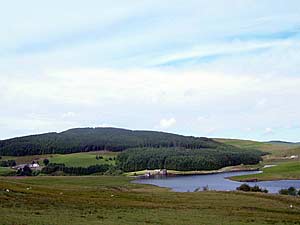
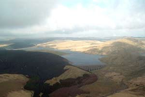
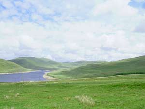
Nantymoch
Reservoirs and associated buildings constructed in the 1960s as
part of a hydroelectric scheme form a major component of the Nant-y-Moch
historic landscape. Other components comprise scattered hill farms,
Bronze Age funerary and ritual monuments and the remains of metal
mines. |
|
Peraidd
Fynnydd
Peraidd Fynydd consists of an extensive 20th century coniferous
plantation straddling the county boundary of Ceredigion/Powys. It
was established mainly over open moorland, but a Roman fort, abandoned
settlements and Bronze Age funerary and ritual monuments are evidence
of a more actively exploited landscape. |
|
Ponterwyd
Many of the elements of the Ponterwyd historic landscape date to
the 19th century when the developing lead mining industry and the
construction of a turnpike road opened up what had once been a fairly
remote area. The village, remains of the mining industry, dispersed
farms and abandoned cottages are testimony to this period of expansion
and change. |
|
Pumlimon
High open moorland is the defining characteristic of the Pumlimon
landscape. Deserted historic settlements, old metal mines and Bronze
Age funerary and ritual monuments testify to a landscape that has
been intensively exploited in the past. |
|
Pwllpeiran
Pwllpeiran is a complex area. It is essentially agricultural, with
dispersed farms and improved pasture fields divided by banks with
hedges and by dry-stone walls. It includes, however, the 19th century
industrial hamlet of Cwmystwyth and the large modern experimental
farm of Pwllpeiran. |
|
Rhos y Gargoed
& Rhos Marchnant
Rhos y Gargoed and Rhos Marchnant is an upland fringe historic
landscape character area comprising old fields, now mainly abandoned,
deserted settlements, pockets of moorland and coniferous forestry. |
|
Syfydrin
The landscape area of Syfydrin consists of a pocket of improved
grazing with upland farms surrounded by open moorland or upland
coniferous plantations. |
|
Tynddol
Tynddol is an upland fringe area and consists of a single farm
set within a pocket of improved pasture. |
|
Tywi
Forest
Tywi Forest is a vast tract of coniferous plantation established
in the 1960s over what had been chiefly open moorland. Abandoned
post-Medieval settlements and Bronze Age funerary and ritual monuments
demonstrate that this landscape was more intensively used in the
past. |
|
Upper
Ystwyth Valley
Lying at the head of a steep-sided glacial valley, the Upper Ystwyth
Valley historic landscape character area is the last of block of
farmland before open moorland to the east. It consists of dispersed
farms and pasture fields divided by dry-stone walls and stony banks. |
|
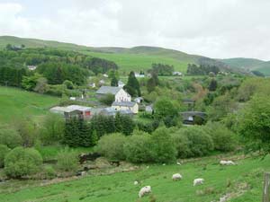
Ysbyty Cynfyn
Small fields of pastures and dispersed farms are some of the main
components of the Ysbyty Cynfyn landscape. It was once a more populated
landscape, attested by several deserted farms and cottages. The
small church of Ysbyty Cynfyn with several standing stones built
into the churchyard wall lies in the centre of this area.
|
|