Home > Historic Landscape Characterisation > Upland Ceredigion > |

 BANC LETTY IFAN HEN
GRID REFERENCE: SN 693850
AREA IN HECTARES: 88.6
Historic Background
In the Medieval Period this area formed part of Y Dywarchen Grange belonging to Strata Florida Abbey, when it seems to have served as upland grazing with a ‘summer house’ or hafod (Williams 1990, 57). Its later history is uncertain, but upon the Dissolution it seems to have passed into the Gogerddan estate. It was unenclosed sheep-walk with no settlements until the 1840s, after which it was divided into large fields. Metal mining first started in the area in the 1840s with the Lletty Evanhen mine, which continued to be worked until 1911 (Bick 1988, 32).
Description and essential historic landscape components
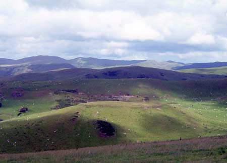
This small area consists of that part of a craggy ridge lying between high, unenclosed land to the east and lower enclosed land to the west. The maximum height of the area is 300m, with the flanks descending to 200m. Old, large enclosures defined by earth and stony banks are now redundant, and the area has essentially reverted to open land divided by occasional wire fences. Improved grazing dominates, though there are patches of rough ground and bracken, especially on steep slopes. It is a treeless landscape. Remains of the metal mining industry are prominent landscape features, and include a wheel-pit, engine house, viaduct and other features. The northern flanks of this area are crossed by leats that served the metal mining industry (Tucker 1976).
Recorded archaeology of this area includes a well-preserved Iron Age hillfort - Pen-y-castel - and two Bronze Age standing stones. Deserted post-Medieval settlements on the fringes of the area testify to a settled landscape in the relatively recent past.
This is quite a well-defined landscape area, sandwiched between unenclosed land to the east, forestry to the southeast and lower-lying enclosed land to the northwest, west and southwest.
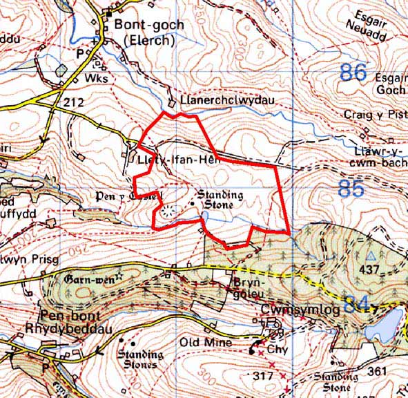
Base map reproduced from the OS map with the permission
of Ordnance Survey on behalf of The Controller of Her Majesty's Stationery
Office, © Crown Copyright 2001.
All rights reserved. Unauthorised reproduction infringes Crown Copyright
and may lead to prosecution or civil proceedings. Licence Number: GD272221