Home > Historic Landscape Characterisation > Upland Ceredigion > |

 BLAEN PEITHNANT
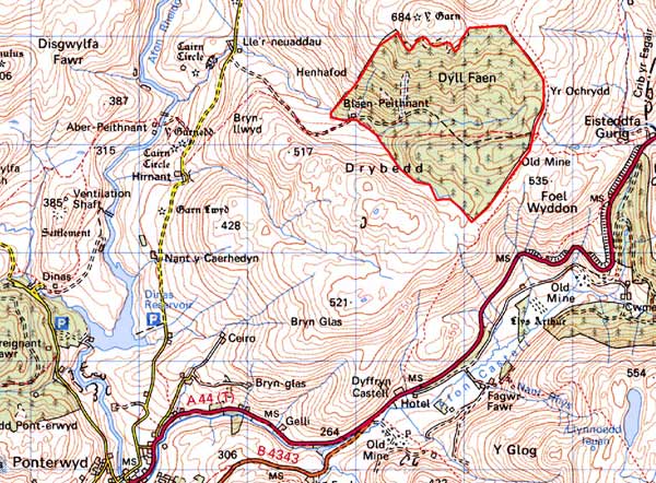
GRID REFERENCE: SN 775841
AREA IN HECTARES: 212.3
Historic Background
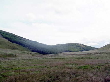
This block of high upland within Gwestfa Cwm Rheidol in Cwmwd Perfedd was probably considered Crown land until relatively recently. It has never been enclosed, and until planted with conifers in the 1960s, was open moorland.
Description and essential historic landscape components
A hard-edged conifer plantation defines this craggy upland area that achieves a height of over 560m. Prior to planting it was unenclosed moorland; now plantations, tracks, roads and other forestry features are the most common and prominent historic landscape components in this area.
The only recorded archaeology in the area is a small metal mine.
This forestry area is surrounded by unenclosed moorland.
Base map reproduced from the OS map with the permission
of Ordnance Survey on behalf of The Controller of Her Majesty's Stationery
Office, © Crown Copyright 2001.
All rights reserved. Unauthorised reproduction infringes Crown Copyright
and may lead to prosecution or civil proceedings. Licence Number: GD272221