Home > Historic Landscape Characterisation > Upland Ceredigion > |

 BRYNGWYN
GRID REFERENCE: SN 645870
AREA IN HECTARES: 537.2
Historic Background
The early history of this area has not been researched. By the late 18th century nearly all the land was divided between the estates of Gogerddan, Court Grange, Bryngwyn and Cynull Mawr. Estate maps (NLW Gogerddan 35, 36; NLW R.M. C22; NLW Vol 38, 8; NLW Vol 42) of the late 18th and early 19th century show a landscape almost identical to that of today, with dispersed farms, irregular fields and scattered woodland. The origin of the settlement pattern and field system is unknown, but it is likely that the estates mentioned above were created during a period of transition in the late Medieval Period, when the concept of private ownership was becoming accepted. If so, then it is likely that the settlement pattern of dispersed farms dates to at least this period. The field system may have been established contemporaneously with the farms. Place-names such as Maesnewydd and Maes-y-dogn suggest, however, the former presence of a strip- or sub-divided field system.
Description and essential historic landscape components
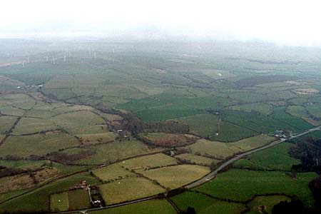
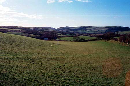
This area consists of undulating west- and northwest-facing slopes of a minor valley lying between 50m and 150m. The historic landscape comprises a settlement pattern of dispersed farms and houses, with a small nucleation of modern houses at Dolau, set in a landscape of irregular, small enclosures, with small stands of deciduous woodland and coniferous plantations. Improved pasture dominates, with very little rough pasture or poor quality land present. Boundaries are mostly of earth banks topped with hedges, with occasional dry-stone walls on the higher slopes. Hedges are generally in good condition, with occasional distinctive trees, but in some areas, particularly at higher levels they are becoming overgrown and neglected.
Local stone – left bare, rendered or painted – is the traditional building material, with commercial slate for roofs. Farmhouses mainly date to the mid to later 19th century, are relatively small, of two storeys and in the typical Georgian vernacular style –gable end chimneys, central front door, and two windows either side of the door and one above. Many have vernacular traits, such as an irregular plan, asymmetrical window layout, low rooms and unequal sized chimneys. However, Maesnewydd is larger and displays strong polite Georgian characteristics, and Pant Glas is a substantial double pile house of probable 18th century date but with vernacular traits. On average farms have two or three ranges of small 19th century stone outbuildings, although more substantial buildings set around a yard demonstrate the greater wealth and status of some farms. Working farms generally have medium sized modern concrete and steel agricultural buildings, but some very large examples are also present. In addition to farms there are dispersed houses, which are generally of the same style and date as the farmhouses, although usually smaller, but with some late 19th century ‘villas’, and a scatter of late 20th and early 21st century houses and bungalows.
The recorded archaeology includes the remains of minor metal mines on the eastern border of the area and two corn mills. A time-depth element to the landscape is provided by a small Iron Age hillfort, four Bronze Age burnt mounds or hearths - possible settlement sites - and finds of Bronze Age date.
This area is not easy to define. To the west and north the landscape areas have yet to be described, and to the east and south this area merges with less ancient but nevertheless similar, land.
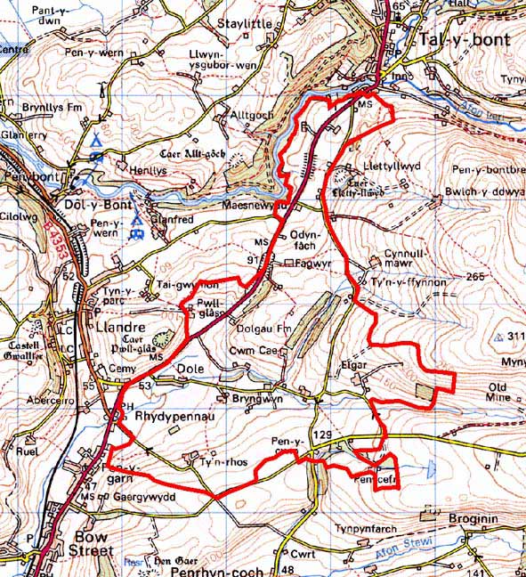
Base map reproduced from the OS map with the permission
of Ordnance Survey on behalf of The Controller of Her Majesty's Stationery
Office, © Crown Copyright 2001.
All rights reserved. Unauthorised reproduction infringes Crown Copyright
and may lead to prosecution or civil proceedings. Licence Number: GD272221