Home > Historic Landscape Characterisation > Upland Ceredigion > |

 BRYN TYN-LLWYN
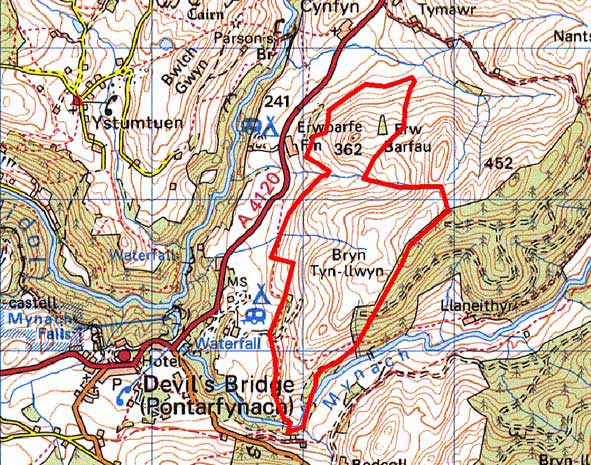
GRID REFERENCE: SN 753776
AREA IN HECTARES: 126.6
Historic Background
Historically this area has functioned as a ‘buffer’ zone between occupied and cultivated lower-lying land to the west, and unenclosed high land to the east. Its early history is unknown, but in more recent times it has served as sheep-walk to Erwbarfe and other farms. The first large-scale map of the area dates to 1819 (NLW Vol 45, 28) and shows a landscape similar to that of today - large enclosures, some labelled ‘sheep pasture’. In times of agricultural prosperity and population expansion the limits of enclosure in this area would have been pushed higher up the slopes, but in times of depression limits of enclosed land would have receded.
Description and essential historic landscape components
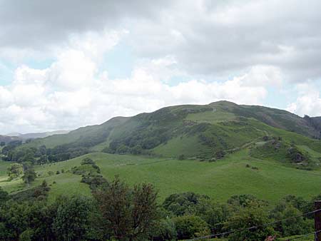
This area consists of steep, and in places craggy, west- and south-facing slope rising from 250m up to a maximum of 420m. Improved grazing dominates, with rougher grazing and bracken on the steeper slopes and higher levels. The area has been divided into a series of enclosures. These tend to be small and irregular on the lower slopes, larger at higher levels, and are divided by earth banks, some topped with hedges. Hedges are now only present on the lower slopes, and here they are overgrown and derelict. At higher levels hedges have gone. Wire fences running along the old earth banks now form stock-proof boundaries. Small stands of broadleaf trees are present on the lower slopes. There are no occupied buildings in the area.
Recorded archaeology indicates a once settled landscape. The sites of four house sites of probable post-Medieval date have been recorded together with a deserted farmstead. Rural industry in the form of charcoal burning has also been recognised. A flourmill and woollen mill lie on the extreme southern boundary of the area.
This is not a particularly well-defined area to the west, north and south where it merges with more intensively farmed, settled lower-lying land. To the northeast definition is better with the boundary of unenclosed land, and is clear with the junction of forestry to the east.
Base map reproduced from the OS map with the permission
of Ordnance Survey on behalf of The Controller of Her Majesty's Stationery
Office, © Crown Copyright 2001.
All rights reserved. Unauthorised reproduction infringes Crown Copyright
and may lead to prosecution or civil proceedings. Licence Number: GD272221