Home > Historic Landscape Characterisation > Upland Ceredigion > |

 CNWCH
CNWCH
GRID REFERENCE: SN 718714
AREA IN HECTARES: 35.1
Historic Background
In the Medieval Period this area lay within Strata Florida Abbey’s Mefenydd Grange. On the Dissolution the granges were granted to the Earl of Essex. Subsequently, in 1630, they were sold to the Crosswood estate. It is likely that the upland, unenclosed character of this area ensured that it was considered Crown land. It has remained essentially unenclosed up to the present day.
Description and essential historic landscape components
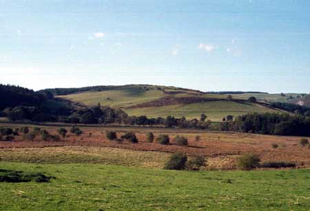
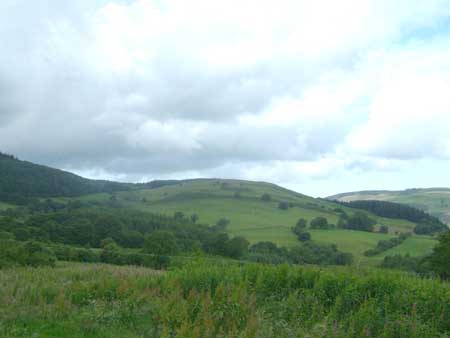
This is a small block of unenclosed land - essentially a hill - ranging from 220m to the east up to 320m to the west. It formerly formed part of a large tract of moorland, but almost all of this is now under coniferous plantation. It is unenclosed and according to the only large-scale manuscript map of the area, the tithe map (Gwnnws Tithe Map and Apportionment, 1847), it has been unenclosed since 1847. It comprises improved grazing with rougher ground and bracken cover on steep, craggy, east-facing slopes. Some redundant earth boundary banks are present on the eastern fringes of this area at its junction with cultivated land. These banks represent the shifting border between unenclosed and enclosed land. Wire fences on the banks now demarcate the boundary. There are several spoil tips from mineral or stone workings. The tithe map marks these as slate quarries.
Clearly the creation of a coniferous plantation on former unenclosed land has robbed this area of much of its coherence and integrity, but sufficient open land survives to warrant its separation into a single landscape character area.
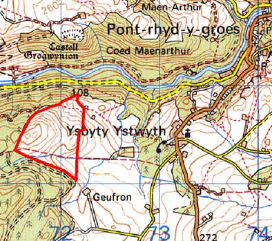
Base map reproduced from the OS map with the permission
of Ordnance Survey on behalf of The Controller of Her Majesty's Stationery
Office, © Crown Copyright 2001.
All rights reserved. Unauthorised reproduction infringes Crown Copyright
and may lead to prosecution or civil proceedings. Licence Number: GD272221