Home > Historic Landscape Characterisation > Upland Ceredigion > |

 COED BWLCHGWALLTER
GRID REFERENCE: SN 771718
AREA IN HECTARES: 337.6
Historic Background
This area, in the Medieval Period, lay within Strata Florida Abbey’s grange of Cwmystwyth. Upon the Dissolution the Herbert family of Powis Castle probably acquired it, along with many other holdings of the former monastery, although the unenclosed portions would have remained Crown land. By the Dissolution, and probably for many decades before, the abbey granges had been divided into farms and leased out on a commercial basis. One farm in this area, Bwlchgwallter, was recorded as such in 1545-50 (Morgan 1991). The Herbert holdings in Cwmystwyth formed the core of Thomas Johnes’s Hafod estate of the late 18th and early 19th century. By 1834 it is clear that the unenclosed Crown land that forms the bulk of this area had been acquired or appropriated by the estate, as it is shown on an estate map. In 1866, unenclosed land was subjected to an Enclosure Act (Chapman 1992, 53; NLW Card CC Deposit 6), which, although awarded, seems to have had little effect on the physical landscape. In the early 1950s the Hafod estate was purchased by the Forestry Commission and a large-scale programme of afforestation initiated. The boundaries of this forestry and the landscape area to the east, south and west follow the extent of the Hafod estate as shown on the 1834 estate map. Bwlchgwallter farmhouse survives in a pocket of un-afforested land.
Description and essential historic landscape components
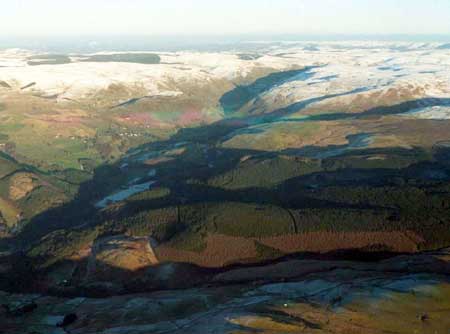
This is a large tract of high undulating land, ranging from 300m to 470m, which is entirely under coniferous plantations. Prior to afforestation the vast bulk of this area was unenclosed moorland and sheep-walk, although some boundaries were present, especially close to Bwlchgwallter house, where the land was divided into fields by earth banks, earth and stone banks and occasional dry-stone walls. The latter probably being the work of Thomas Johnes in the late 18th century; these are all now redundant and under forestry. Bwlchgwallter house, a much modernised, probably 19th century, small house, survives. Plantations, tracks, roads and other forestry features are the most common and prominent historic landscape components.
Apart from a grotto, the recorded archaeology comprises minor post-Medieval agricultural components.
This landscape area is very well defined with open moorland lying to the east and south, open ground with large enclosures to the west and the core of the Hafod estate in the Ystwyth valley to the north.
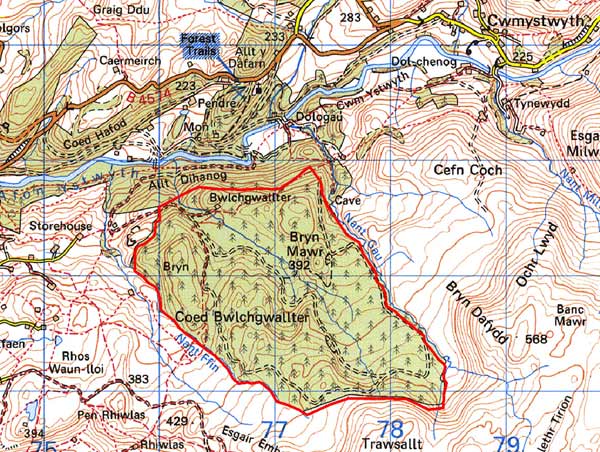
Base map reproduced from the OS map with the permission
of Ordnance Survey on behalf of The Controller of Her Majesty's Stationery
Office, © Crown Copyright 2001.
All rights reserved. Unauthorised reproduction infringes Crown Copyright
and may lead to prosecution or civil proceedings. Licence Number: GD272221