Home > Historic Landscape Characterisation > Upland Ceredigion > |

 COED GRUFFYDD
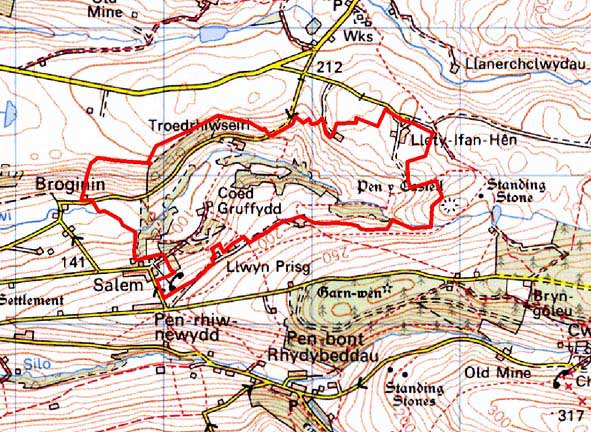
GRID REFERENCE: SN 676848
AREA IN HECTARES: 161.4
Historic Background
In the Medieval Period this area lay within Strata Florida Abbey’s Y Dywarchen Grange. As with most of the granges of Strata Florida, it is likely that by the end of the Middle Ages, if not earlier, Y Dywarchen had been divided into farms that were leased out and farmed on a commercial basis. The settlement pattern probably dates from this time. Upon the Dissolution of the abbey, granges were granted to the Earl of Essex, who in 1630 sold them to the Crosswood estate. It would seem, however, that other estates had leased or otherwise purchased land prior to the grant to the Earl of Essex, as by the 18th century, Goggerddan and Court Grange estates had interests in the area as well as Crosswood. Estate maps of the late 18th century (NLW Crosswood 345/46; NLW Vol 38, 10, 14) show a landscape not dissimilar to that of today - scattered farms, woodland, and small, irregular enclosures on the valley floor and lower valley sides.
Description and essential historic landscape components
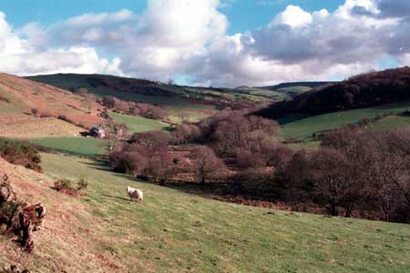
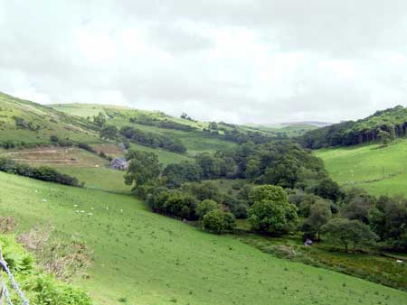
This area comprises the floor and lower slopes of the upper valley of the Afon Stewi, lying between 100m and 250m. The settlement pattern is of dispersed farms. Farmhouses are of stone and probably date to the mid-to-late 19th century, are relatively small, of two storeys and in the typical Georgian vernacular style – gable end chimneys, central front door, two windows either side of the door and one above. One now abandoned farmhouse has strong vernacular traits, but most are later 19th century with dominant Georgian elements. Farms have 19th century stone outbuildings. The smaller farms have just one range, but most have two or three ranges, and extensive ranges of modern concrete and steel agricultural buildings. Farms are located in field systems of small irregular enclosures. These enclosures are formed from earth- or stony-banks topped with hedges. Hedges are now either derelict or overgrown and neglected. Some have entirely disappeared. Many of the hedges have distinctive trees in them. Wire fences now provide stock-proof barriers. Stands of broadleaf woodland and conifer plantations together with the distinctive hedgerow trees lend a highly wooded aspect to the landscape. Farmland consists of a mixture of improved grazing with rougher grazing on some steep slopes, and rushy and peaty ground on the valley bottom. There are some minor remains of the metal mining industry - mostly tips - on the southern valley side.
Recorded archaeology provides no time-depth to this landscape, and consists of just a deserted post-Medieval settlement and remains of the metal mining industry.
This is a highly distinctive and well-contained area. To the north, south and east higher, formerly unenclosed, sparsely settled and treeless upland stands in sharp contrast. To the west this area merges with the more open and intensively settled land of the lower valley.
Base map reproduced from the OS map with the permission
of Ordnance Survey on behalf of The Controller of Her Majesty's Stationery
Office, © Crown Copyright 2001.
All rights reserved. Unauthorised reproduction infringes Crown Copyright
and may lead to prosecution or civil proceedings. Licence Number: GD272221