Home > Historic Landscape Characterisation > Upland Ceredigion > |

 CWM MYNACH
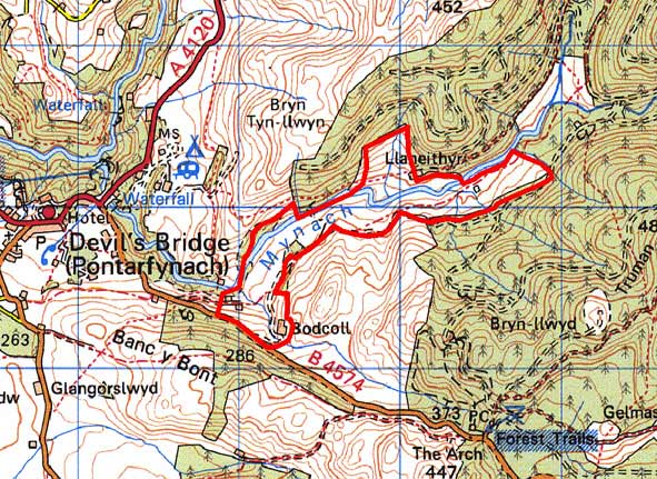
GRID REFERENCE: SN 753768
AREA IN HECTARES: 68.33
Historic Background
In the Medieval Period the portion of this area to the south of the Mynach, if not all of it, formed part of Strata Florida Abbey’s Cwmystwyth Grange. It is probable that on the Dissolution of the abbey the Herbert family purchased this part of the grange. By the early 19th century it had been incorporated into Thomas Johnes’s Hafod estate. The southern portion of it is depicted on an 1834 map of the Hafod estate. By the 16th century the abbey granges had been divided into farms, leased out and farmed as individual units. A document of 1545-50 (Morgan 1991) lists the farms in the Cwmystwyth grange; none of those in this area are mentioned, though unnamed tenements are recorded. It seems likely that along with the rest of the grange this area was divided into farms, and possibly enclosed into the present field system by at least the end of the Medieval Period. The tithe map provides the first good and complete record of the area. This shows a landscape very similar to that of today.
Description and essential historic landscape components
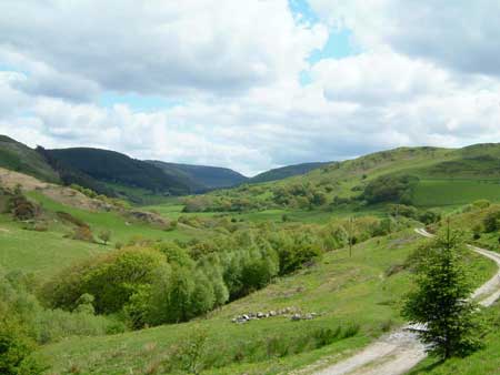
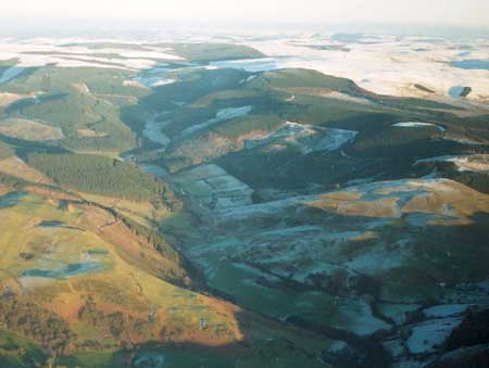
The upper Mynach valley, comprising the valley floor and the lower valley sides, ranges in height from 220m to 280m. The valley here is narrow and steep-sided. The higher valley slopes are now clothed with forestry. Improved grazing is dominant in this area; rougher grazing on steep slopes and rushy hollows are rare. The area is characterised by a system of small, irregular fields that are divided by earth banks topped with hedges. Some hedges are in good condition, but most are no longer stock-proof and are becoming overgrown and neglected. Nevertheless they are a very prominent component of the historic landscape. Wire fences now provide stock-proof boundaries alongside most hedgerows. Small, scattered stands of broadleaf woodland together with the hedgerows gives an impression of a moderately wooded landscape. Two farms comprise the settlement pattern. The house of one of these seems to have been recently rebuilt. The other is a fine example of an upland farm, with a two-storey, strongly vernacular painted stone house (but in the regional Georgian vernacular tradition), probably dating to the early 19th century, with several stone outbuildings set semi formally around a yard, and modern agricultural buildings.
Recorded archaeology mainly consists of the remains of the metal mining industry. Several place-names are of interest as they provide a certain time-depth to the landscape, and may indicate the location of Dark Age cemeteries or monastic foundations.
This area is very well defined. To the northeast, east and southeast, on the higher slopes of the valley side lies 20th century forestry plantation. Unenclosed land lies to the south and an area of large enclosures to the north.
Base map reproduced from the OS map with the permission
of Ordnance Survey on behalf of The Controller of Her Majesty's Stationery
Office, © Crown Copyright 2001.
All rights reserved. Unauthorised reproduction infringes Crown Copyright
and may lead to prosecution or civil proceedings. Licence Number: GD272221