Home > Historic Landscape Characterisation > Upland Ceredigion > |

 CYNNULL
GRID REFERENCE: SN 655877
AREA IN HECTARES: 178.2
Historic Background
The history of this area has not been researched. It would seem, however, that the two farms of Cynull Mawr and Argoed Fach are important settlements of some antiquity; perhaps based on pre Anglo-Norman tribal land holding. In 1764 the demesnes of Cynnull Mawr and Argoed Fach were recorded on an estate map (NLW Gogerddan 35). It seems likely that this estate was carved out from a pre-existing tenurial system in the late Medieval or early modern period when the concept of private ownership was gaining acceptance. The 1764 estate map shows the two farms (plus a deserted farm), associated with a few, small irregular fields, and open ground or large enclosures of arable and pasture further out. On the western boundary of the area, on lower slopes, a system of irregular fields is shown. By the mid 19th century all of this area had been enclosed, though on higher ground larger enclosures are evident from cartographic sources. The area has changed little since the mid 19th century.
Description and essential historic landscape components
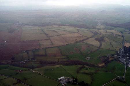
This area is essentially a buffer zone between the more populated and enclosed lower-lying land to the west, and unenclosed upland to the east. It consists of the western flanks of a hill, with the lower slopes running down to below 100m, and the summit at over 250m. It is a landscape of dispersed farms set in a system of irregular fields. Boundaries to the fields are varied. Generally they consist of earth, or earth and stone banks topped with hedges, though more substantial stone-built banks with occasional orthostats are present close to Cynnull Mawr. Occasional, collapsing dry-stone walls are also present. Hedges are generally in good condition alongside public roads, in fair condition on the lower slopes, but overgrown and/or derelict elsewhere. Wire fences augment most boundaries. Improved grazing dominates, with rougher land on some steep slopes. There are some small stands of deciduous woodland and a conifer plantation.
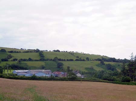
Only a few buildings were inspected in this area. Cynnull Mawr is a typical 19th century regional style farm in the Georgian vernacular tradition, with stronger Georgian traits than vernacular. Several large modern outbuildings lie a little way from the farm.
The recorded archaeology is dominated by a substantial Iron Age fort - Caer Lletty Llwyd – and its associated features. Post-medieval mining and quarrying has also been recorded.
To the east this area is defined by former unenclosed
moorland. On other sides, definition is less clear, and this area tends
to merge with lower-lying enclosed land.
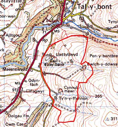
Base map reproduced from the OS map with the permission
of Ordnance Survey on behalf of The Controller of Her Majesty's Stationery
Office, © Crown Copyright 2001.
All rights reserved. Unauthorised reproduction infringes Crown Copyright
and may lead to prosecution or civil proceedings. Licence Number: GD272221