Home > Historic Landscape Characterisation > Upland Ceredigion > |

 ESGAIR FRAITH
GRID REFERENCE: SN 755908
AREA IN HECTARES: 1540
Historic Background
This very large block of former unenclosed upland lay within Cwmwd Gene u’r glyn, which was probably considered Crown land until fairly recently. Map evidence indicates that almost all the area was unenclosed, although some settlements are recorded. Within or close to the boundaries of this area are several important metal mines: Henfwlch, Camdwrbach, Eaglebrook, Esgair Hir and Esgair Fraith (Bick 1988). The last two are of considerable antiquity and richness, known as the Welsh Potosi (Palmer 1983). It was at Esgair Hir that Sir Carberrry Pryse in 1689 challenged the Crown monopoly on mining silver and gold. His victory opened up the mining industry to new capital, resulting in new mines and encouraged the development of existing workings. Working of these mainly lead and copper mines continued from the 17th century through to the early 19th century. Aside from metal mining, this area remained remote and under-used until the acquisition of the land by the Forestry Commission and the planting of conifer plantations in the 1960s.
Description and essential historic landscape components
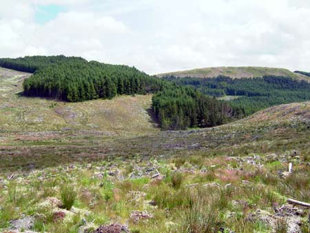
This craggy upland area, which achieves a height of over 490m, is covered by hard-edged conifer plantation. Within the forestry are the scattered remains of the metal mining industry including tips, shafts and wheel pits and buildings, though most of the important structures of the two main mines, Esgair Hir and Esgair Fraith, lie outside the forestry. Prior to planting most of this area was unenclosed moorland; now it is the plantations, tracks, roads and other forestry features that are the most common and prominent historic landscape components in this area.
Apart from numerous metal mining remains, the recorded archaeology consists of several abandoned long huts and other settlements. These indicate an inhabited area, albeit sparsely populated, prior to the 19th century. Agricultural remains - folds etc - of the post-Medieval Period are also present. A Bronze Age round barrow gives a certain time-depth to the landscape.
Historic landscape areas which border this unit have
largely yet to be defined and described. However, open moorland bounds
this area to the east and Nant-y-moch reservoir to the southeast.
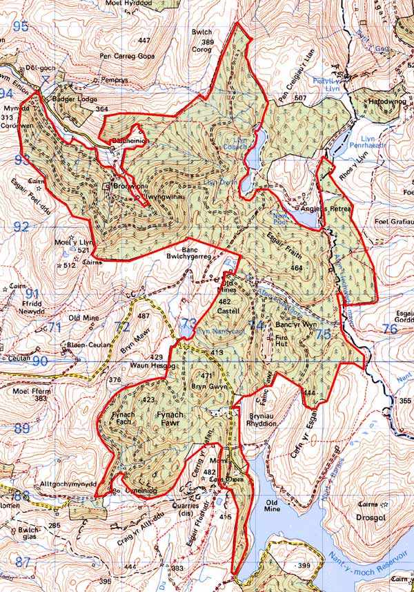
Base map reproduced from the OS map with the permission
of Ordnance Survey on behalf of The Controller of Her Majesty's Stationery
Office, © Crown Copyright 2001.
All rights reserved. Unauthorised reproduction infringes Crown Copyright
and may lead to prosecution or civil proceedings. Licence Number: GD272221