Home > Historic Landscape Characterisation > Upland Ceredigion > |

 GROGWYNION & GWAITHGOCH
GRID REFERENCE: SN 703720
AREA IN HECTARES: 112.1
Historic Background
The southern part of this area in the Ystwyth valley seems to have been included in the northern limits of Strata Florida’s grange of Mefenydd (Williams 1990, 57). This grange was amongst the land acquired by the Crosswood estate from the dissolved abbey. Estate maps of the late 18th century demonstrate that it formed part of the Crosswood Estate during this period (NLW Crosswood Deeds 5, Ser IV, Vol 1; 49), although the Gogerddan estate acquired one farmstead (NLW Gogerddan 54, 55).
Prominent historical components in this area are the remains of two lead mines: Groggwynion and Gwaithgoch. Grogwynion is an ancient mine, and the subject of a lawsuit in the 1740s. The Gogerddan estate owned Pengrogwynion farm and the Crosswood estate the surrounding land. Crosswood had made new mineral leases to the Mine Adventures of England in 1742, a lease that the Gogerddan estate contested (Morgan 1997, 219). The main period of working of Grogwyion was from the 1790s, with a particularly flourishing period in the 1880s (Bick 1974, 17-18). Gwaithgoch ceased working over a century ago, though a Government scheme to rework the waste tips of Frongoch mine was set up during World War One, with the spoil carried to a works built on the banks of the Ystwyth by aerial ropeway. These works closed in the 1920s.
Included in this area are several farmsteads on the lower, north-facing valley side. Documentary evidence demonstrates that they date to at least the mid 18th century (Morgan 1997, 219), and are probably of much greater antiquity. The Llanafan tithe map of 1845 shows these farmsteads and their associated field systems.
Description and essential historic landscape components
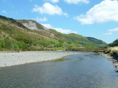
The Ystwyth in this landscape character area passes through a very steep-sided and craggy valley. The valley floor is at about 80m, but the sides rise to over 350m. The valley floor, the lower northern slopes and part of the higher northern slopes, are the only sections of valley not under forestry and are therefore included in this area. The valley floor consists of unenclosed rough ground with rushes and peaty deposits. Given the narrowness of the valley floor and its waterlogged nature it is probable that this flood plain has never been subjected to enclosure or intensive cultivation, and that its agricultural use in the past has been similar to todays; that of seasonal rough grazing.
A couple of farmsteads with associated field systems of small enclosures lie on the lower northern slopes. Low banks topped by hedges separate the pasture fields of these enclosures. The hedges are in poor condition, are not stock-proof and are supplemented by wire. The farms are no longer working. The houses are stone-built, cement rendered or bare stone and in the mid to late 19th century typical Georgian vernacular style of the region – gable end chimneys, central front door, and two windows either side of the door and one above. Stone-built outbuildings are small, with some attached and in-line to the house. Slate and red tile are present on the houses. There are no substantial modern farm buildings. At the extreme western end of the valley floor is a working sawmill.
The un-forested, steep northern valley sides are covered with scree from spoil heaps. These spoil heaps encroach across the valley floor at the eastern end of the valley. A wheel pit and shafts of the Grogwynion mine are visible on the surface. At the foot of the north-facing slope are the massive stone-built remains of Gwaithgoch crushing mill and dressing mill. These date to World War One and the following decade. All recorded archaeology in this area consists entirely of metal mining remains or other industrial workings.
This character area is very well defined on all sides.
To the east the Ystwyth emerges from a narrow, wooded gorge. Steep valley
sides define the area to the north and south, and to the west the valley
opens out into enclosed land.
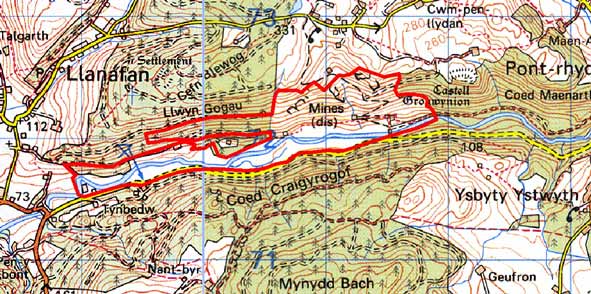
Base map reproduced from the OS map with the permission
of Ordnance Survey on behalf of The Controller of Her Majesty's Stationery
Office, © Crown Copyright 2001.
All rights reserved. Unauthorised reproduction infringes Crown Copyright
and may lead to prosecution or civil proceedings. Licence Number: GD272221