Home > Historic Landscape Characterisation > Upland Ceredigion > |

 LLANAFAN
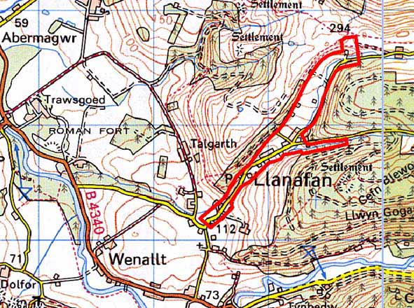
GRID REFERENCE: SN 691729
AREA IN HECTARES: 35.7
Historic Background
This area includes St Afan’s Church. The dedication indicates a pre Anglo-Norman foundation, though this was not a parish church during the Medieval Period, but a chapelry of Llanfihangel-y-Creuddyn parish. It was created a parish in 1833. The church was completely rebuilt in 1833 (Ludlow 1998). At least part of this area lay within the demesne of Crosswood, and it is likely that the history of Llanafan village is intimately linked to that of the Crosswood estate, and therefore of post-Medieval origin. The history of the village, however, has not been researched, but on estate maps of the mid and late 18th century (NLW 7188, NLW Crosswood Vol 1, 43) it consists of several dwellings spaced along a road set in a landscape of small, regular fields. A similar picture is shown on the tithe map of 1845. The overall pattern of the village at this period is of a squatter settlement that had developed during the late 18th and early 19th centuries, but without further research this cannot be substantiated and it may have estate origins. The second half of the 19th century and the 20th century have seen further development, with most of the gaps between the widely spaced, older dwellings filled by single houses or small-scale developments.
Description and essential historic landscape components
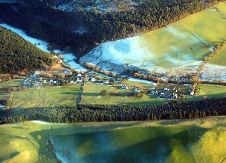
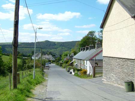
The village of Llanafan lies in the steep-sided, narrow valley of Nant Pant-y-haidd at approximately 100m. It is a linear village of houses with a listed 19th century estate church, a school and teacher’s house, and a village hall a little distance away. Older dwellings of the linear village lie dispersed on one side of a road. They are mainly worker houses – there is very little evidence of agricultural outbuildings – and are stone built, generally cement rendered, with slate roofs. They date to the mid to late 19th century and are in the typical Georgian vernacular style of the region, but generally have strong vernacular traits. Short terraces, semi-detached and detached examples are present, with examples of one, one-and-a-half and two storey houses/cottages present. Many have been modernised and extended. Mid and late 20th century and 21st century houses now infill the gaps between the older houses, producing a true linear village with strong late 20th century characteristics.
To the eastern, higher valley, end of the area the village fades into an agricultural landscape of scattered farms set in a field system of small, fairly regular-shaped fields. Boundaries are of earth banks topped with hedges, though hedges no longer exist or are derelict. Wire fences provide stock-proof boundaries. Farmland is improved pasture or rough grazing.
The recorded archaeology consists of St Afan’s Church, a post-Medieval dwelling and a post-Medieval quarry.
To the southeast and northwest this area is very well
defined by forestry or unenclosed land, but to the south this area is
less well defined and tends to merge with the neighbouring enclosed farmland.
Base map reproduced from the OS map with the permission
of Ordnance Survey on behalf of The Controller of Her Majesty's Stationery
Office, © Crown Copyright 2001.
All rights reserved. Unauthorised reproduction infringes Crown Copyright
and may lead to prosecution or civil proceedings. Licence Number: GD272221