Home > Historic Landscape Characterisation > Upland Ceredigion > |

 LLWYN-CRYCHYDDOD
GRID REFERENCE: SN 668772
AREA IN HECTARES: 61.6
Historic Background
This small area, which contains no settlements, appears to have undergone a transformation in the early 19th century, when the first large-scale estate map (NLW Vol 45, 33) was surveyed, from an area of unenclosed sheep-walk to a landscape of medium-sized, regular-shaped fields. The estate map shows that land at the southern limit of this area had been enclosed by 1819, the remainder being open land. By the tithe survey of the 1840s the whole area had been divided into fields. This area has not significantly changed since then.
Description and essential historic landscape components
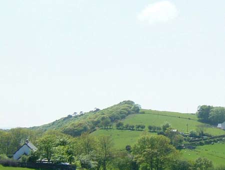
This is a small area of rounded ridge top and south-facing valley side ranging in height from 150m to 240m. There are no inhabited settlements. The area is divided by earth banks into a field system of medium-sized regular enclosures. The banks were formerly topped with hedges, but these are now either derelict or no longer exist. Wire fences now form the boundaries between fields. Improved pasture dominates the area, with very little rougher ground present.
The area is not particularly well defined as neighbouring units to the south and east are visually similar, but have evolved in a different manner. To the north, woodland forms a clear boundary to this area.
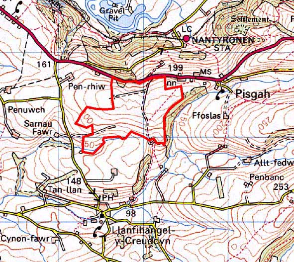
Base map reproduced from the OS map with the permission
of Ordnance Survey on behalf of The Controller of Her Majesty's Stationery
Office, © Crown Copyright 2001.
All rights reserved. Unauthorised reproduction infringes Crown Copyright
and may lead to prosecution or civil proceedings. Licence Number: GD272221