Home > Historic Landscape Characterisation > Upland Ceredigion > |

 PANT-Y-HAIDD
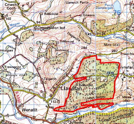
GRID REFERENCE: SN 697726
AREA IN HECTARES: 205.7
Historic Background
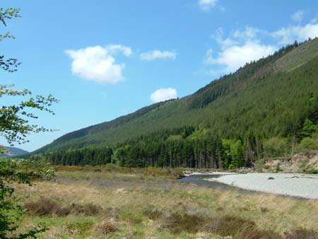
The history of this area has not been researched, however, its high elevation and steep valley sides probably means that it has been unenclosed moorland or rough grazing for much of the past. It formed part of the Crosswood estate by the 18th century, and an estate map of 1781 (NLW Crosswood Vol 1, 47) shows it unenclosed. A similar pattern is depicted on the tithe map (Llanafan tithe map and apportionment, 1845), but by the end of the 19th century the area had been divided into very large enclosures. The whole area has now been subjected to afforestation. Planting began on the steep valley sides on land purchased from the Crosswood estate in the 1930s (Edlin 1959, 13), and continued post World War Two on higher ground.
Description and essential historic landscape components
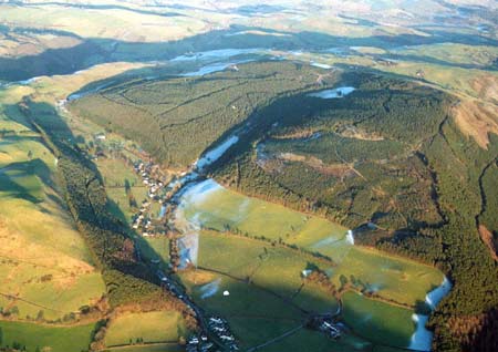
This area comprises part of the very steep north-facing
valley side of the Ystwyth and the high ground above. Lower slopes of
the valley side run down to 100m, high points achieve heights of over
340m.
Apart from a small enclave that contains a settlement, the whole area
has been afforested. A surviving house probably dates to the 19th century,
but is heavily modernised. Prior to planting the area seems to have been
open ground, though it had been divided into large fields during the second
half of the 19th century.
A time-depth element to this landscape is provided by Cefn Blewog Iron Age fort. The earthworks of this important site now lie deep in forestry. The only other significant remains are those of the metal mining industries that mostly date to the 19th century.
It is a well defined area of forestry.
Base map reproduced from the OS map with the permission
of Ordnance Survey on behalf of The Controller of Her Majesty's Stationery
Office, © Crown Copyright 2001.
All rights reserved. Unauthorised reproduction infringes Crown Copyright
and may lead to prosecution or civil proceedings. Licence Number: GD272221