Home > Historic Landscape Characterisation > Upland Ceredigion > |

 RHOS Y GARGOED AND RHOS MARCHNANT
GRID REFERENCE: SN 763684
AREA IN HECTARES: 364.7
Historic Background
In the Medieval Period this area formed part of Strata Florida Abbey’s Mefenydd Grange. At the Dissolution the Earl of Essex was granted abbey land, the greater portion of which was purchased by the Crosswood estate in 1630, including lands close to this area. The later history of this area is uncertain, though its unenclosed upland nature probably ensured that it was considered Crown land. It came to the interest of the Crosswood estate in the early 19th century when there were plans to enclose this area by Act of Parliament, and a survey was undertaken to facilitate this in 1815 (NLW Crosswood 347), but no award was granted. The 1815 survey shows the area almost entirely unenclosed. Other late 18th and early 19th century estate maps (NLW Vol 2, 4; NLW Vol 45, 72) show a similar situation, as does the 1844 tithe map (Gwnnws Tithe Map and Apportionment). In the latter half of the 19th century the area was divided into very large enclosures. Several, probable, squatter settlements were also founded. The enclosures are now deserted, as are several of the settlements. It is not certain when they fell into disuse. In the 1960s a forestry plantation was established.
Documented metal mining began here in the mid 18th century, but does not seem to have been particularly successful, mainly owing to the remoteness of the area (Bick 1974, 34).
Description and essential historic landscape components
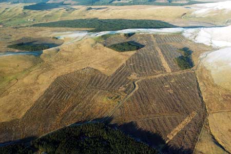
This is an upland fringe area located between 300 and 470m. This area has been subdivided into a series of large enclosures in the past, but these are now mainly redundant and the area is now essentially unenclosed. Former boundaries consist of earth banks. There are now no hedges on these banks and stock-proof boundaries now comprise wire fences. Large blocks of this area are under forestry plantation. Some settlements of stone-built dwellings are present, including at least two deserted houses. Land-use is mainly very rough grazing and moorland with extensive pockets of peaty ground. In 1988, large conifer plantations were clear-felled. Remains of metal mining in this area are not substantial but comprise spoil tips and leats.
Apart from the remains of the metal mining industry and the deserted 19th and 20th century settlements mentioned above, the recorded archaeology comprises two doubtful Bronze Age round barrows.
The limits of this area are not particularly well defined. To the east lies higher mainly unenclosed moorland. To the west the landscape is similar in many characteristics to this area. Only to the south is there a distinct border with its neighbour, characterised by small enclosures of improved pasture within the bottom or lower valley sides.
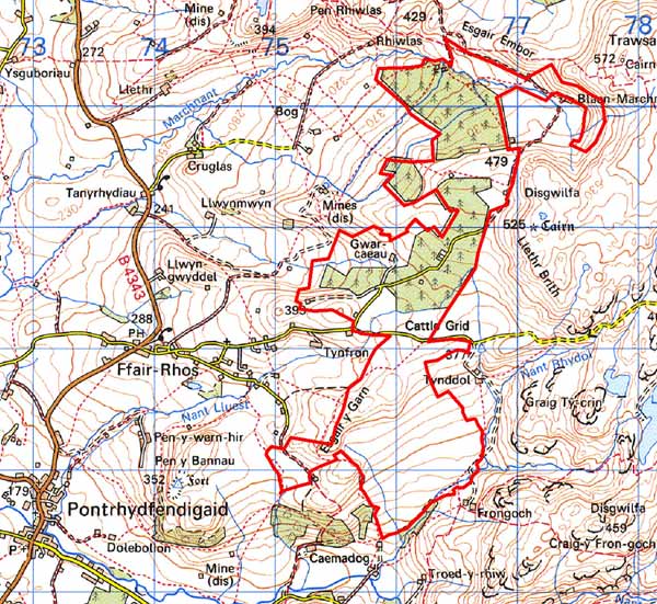
Base map reproduced from the OS map with the permission
of Ordnance Survey on behalf of The Controller of Her Majesty's Stationery
Office, © Crown Copyright 2001.
All rights reserved. Unauthorised reproduction infringes Crown Copyright
and may lead to prosecution or civil proceedings. Licence Number: GD272221