Home > Historic Landscape Characterisation > Upland Ceredigion > |

 RHYDPERERINION
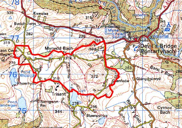
GRID REFERENCE: SN 719761
AREA IN HECTARES: 252.6
Historic Background
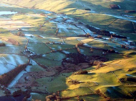
As with neighbouring areas the early history of this area has not been investigated, and little is known. However, unlike some of its neighbouring areas, it was not part of a grange of Strata Florida Abbey. By the 18th century it was divided between the estates of Crosswood and Nanteos. Early 19th century estate maps (NLW Vol 45; 30, 31) show a landscape of scattered farms, each surrounded by small fields, with larger enclosures and unenclosed sheep-walk further out. Apart from some sub-division of the larger fields and enclosure of parts of the sheep-walk, this pattern had changed little by the time of the tithe survey of 1847. Gradually over the remainder of the 19th century the remaining unenclosed land was converted into fields.
Description and essential historic landscape components
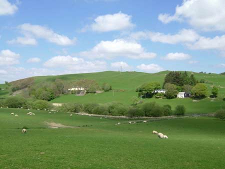
This is an undulating plateau area ranging in height from 270m to 290m. Most of the ground now comprises improved grazing, but there are peaty hollows and rougher grazing on steep slopes. All the land is enclosed or has been subjected to enclosure, but fields on the higher slopes and summits now tend to be farmed as large units sub-divided by wire fences. Some of these fences follow the course of old, low earth banks. On lower ground small irregular fields divided by earth banks are present. Hedges that top the banks are generally in poor condition, overgrown, rarely stock-proof and supplemented by wire. As a general rule, the closer to the farmhouse, the better the condition of the hedge.
Dispersed dwellings, but with a closer grouping than that found in the area to the south, characterise the settlement pattern of this area. There are small, loose settlement clusters at Mynydd Bach and Capel Trisant. Traditional buildings are stone built with slate roofs. Walls on houses are either cement rendered, bare stone or painted, and bare stone on farm outbuildings. Houses, including farmhouses, are small and almost entirely date to the mid-to-late 19th century. They are of two storeys and in the typical Georgian vernacular style – gable end chimneys, central front door, and two windows either side of the door and one above. Vernacular traits such as low eaves, small windows and one chimney larger than the other are more common than more formal Georgian elements. Two or three houses are strongly vernacular. Stone-built outbuildings are generally confined to one or two small ranges, with some attached and in-line to the house. Several farms are no longer working. Working farms have small ranges of modern agricultural buildings. A small listed chapel is at Trisant. There are a few modern houses and bungalows.
Stone quarrying has been carried out in this area, and along the southern boundary are the remains of lead mining activities associated with Frongoch mine.
The recorded archaeology in this area is not diverse, and consists of post-Medieval sites, houses and cottages and minor industrial remains.
This is not a particularly well defined historic landscape area. Areas to the south and north are characterised by a more dispersed settlement pattern and larger field patterning. Frongoch also contains distinctive mining remains. To the east, poorer-quality, lower-lying ground contains a squatter settlement.
Base map reproduced from the OS map with the permission
of Ordnance Survey on behalf of The Controller of Her Majesty's Stationery
Office, © Crown Copyright 2001.
All rights reserved. Unauthorised reproduction infringes Crown Copyright
and may lead to prosecution or civil proceedings. Licence Number: GD272221