Home > Historic Landscape Characterisation > Upland Ceredigion > |

 SYFYDRIN
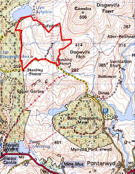
GRID REFERENCE: SN 727839
AREA IN HECTARES: 98.6
Historic Background
In the Medieval Period this area may have formed part of Cwm-hir Abbey’s Nantyrarian Grange. If so, Syfydrin and Gwenffrwd-uchaf farms may have originated in the latter Middle Ages when granges were split into separate farms and leased out on a commercial basis. By the late 18th century at least part of the area appears to be owned by the Gogerddan estate, by which time the farms were well established. Estate maps (NLW Gogerddan 71; NLW Vol 37, 47) show a holding with farm buildings set in a couple of small fields surrounded by unenclosed sheep-walk. The tithe map (Llanbadarnfawr, 1845) shows all settlements in this area - a total of seven were then present - each with one or two adjacent fields. An ancient north - south route - the Machynlleth to Ffair Rhos road on estate maps - passes through this area. This may account for the establishment of dwellings and settlements here, though by the mid 19th century this road had fallen out of use. Land was divided into large enclosures during the 19th century, but since the early years of the 20th century there has been a general decrease in settlement size.
Description and essential historic landscape components
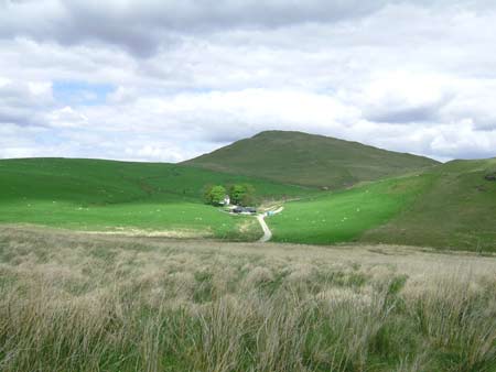
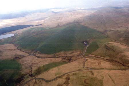
This area, lying at 320m-380m, is one of improved grazing and few farms, bounded on one side by forestry and elsewhere by unenclosed upland. Essentially it comprises land that has been divided into large fields by earth and stony banks, although these are now redundant and wire fences provide stock proof barriers. The highly improved grazing of most of this area is in sharp contrast with the very rough ground of the neighbouring moorland. The fringes of the area contain rough unimproved land. One of the farmhouses is stone-built in the typical late 19th century regional Georgian vernacular tradition and has adjacent, small farm buildings. There are also deserted farmsteads. Apart from trees close to the farmsteads, this is a treeless landscape.
In addition to the settlements mentioned above, the recorded archaeology includes deserted post-Medieval dwellings. Three Bronze Age standing stones provide time depth to the landscape.
This is a very distinct landscape area and is in sharp contrast with forestry to the west, and unenclosed moorland on all other sides.
Base map reproduced from the OS map with the permission
of Ordnance Survey on behalf of The Controller of Her Majesty's Stationery
Office, © Crown Copyright 2001.
All rights reserved. Unauthorised reproduction infringes Crown Copyright
and may lead to prosecution or civil proceedings. Licence Number: GD272221