Home > Historic Landscape Characterisation > Upland Ceredigion > |

 TYWI FOREST
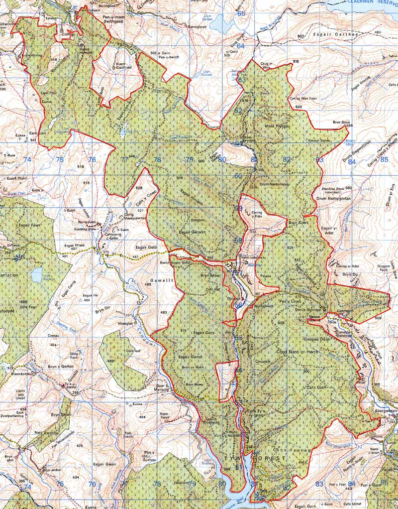
GRID REFERENCE: SN 792575
AREA IN HECTARES: 6879
Historic Background
In the Medieval Period most of this very large tract of upland lay within the Bishop of St David’s Llanddewi Breifi estate or within Strata Florida Abbey’s Pennardd Grange. In more recent times, low-lying fringes of the area came within the control of secular estates - Crosswood owned some land to the north – though the majority was probably considered Crown land because of its unenclosed nature. Late 18th century estate maps (NLW Crosswood Vol 2, 2, 7; NLW Vol 45, 64, 67) show limited enclosure and settlement on the northern fringes of this area around Crofftau and Hafod-newydd, but all the remainder as unenclosed moorland. The area remained open moorland until the blanket afforestation undertaken in the 1960s.
Description and essential historic landscape components
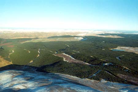
This is a vast tract of hard-edged forestry lying across (mostly) former open land. It achieves a maximum height of over 500m, but is on average between 400-450m high. Apart from a number of enclosures on the fringes, this area was entirely unenclosed moorland prior to afforestation in the 1960s. The plantations, tracks and other features of afforestation now form the major landscape components of this area. Included in this area is the cottage/farmstead of Hafod-newydd, but this has not been examined in the field.
The recorded archaeology in this area consists mainly of post-Medieval settlements and Bronze Age ritual and funerary sites. Deserted buildings of post-Medieval date testify to a once populated, albeit sparsely, landscape and Bronze Age round barrows/burial cairns, a ring-barrow and two possible standing stones add a time-depth dimension to the landscape.
This area is clearly defined by neighbouring open land, and enclosed lower-lying land to the north.
This is a vast area, a large proportion of which lies outside the bounds of the present study, and therefore needs to be examined in greater detail.
Base map reproduced from the OS map with the permission
of Ordnance Survey on behalf of The Controller of Her Majesty's Stationery
Office, © Crown Copyright 2001.
All rights reserved. Unauthorised reproduction infringes Crown Copyright
and may lead to prosecution or civil proceedings. Licence Number: GD272221