By itself the LiDAR survey can be difficult to understand, but using
computers the LiDAR data can be viewed in different ways to make it more understandable.
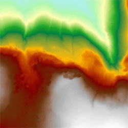
A digital terrain model of Herbert’s Quarry
|
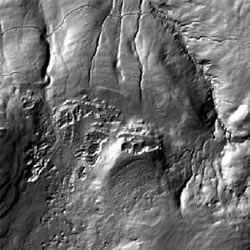
Shaded relief image of the same area
|
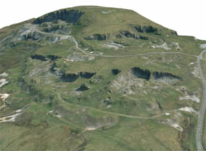
We can also drape an aerial photograph of the area over the LiDAR
survey to produce a 3D image of the site.
We can use this bird’s eye view to help us understand the whole
of the site as it is today.
By comparing the site as it is today with old maps and photographs
of the same area we can work out how the site has changed over the years, and which
parts are the oldest.
Why not explore the site in 3D from the comfort of your armchair
and see what you can discover?
As the project progresses the 3D map image will be developed further.
To view the 3D map you need to have Cortona 3D installed on your
computer. You can download it free here,
http://www.cortona3d.com/install.aspx
You will need to know whether your operating system is 32-bit or
64-bit before deciding which version to download.
Download the program and follow the on screen instructions, then
refresh this page to view the map. Instructions for how to use the Cortona 3D viewer
can be downloaded
in PDF format here by clicking on the link on the right hand side of the page.