

This project was undertaken in partnership with the RCAHMW. The Environment Agency supplied Lidar data.
Coastal promontory forts are highly visible monuments experiencing constant erosion from the sea. This erosion is expected to worsen significantly with climate change. Most forts also lie on or alongside the Pembrokeshire Coast Path and consequently suffer from low-level visitor erosion. However, it has not been possible to quantify either the location or rate of erosion due to the lack of modern site plans and site descriptions. This project aims to rectify this by establishing baseline data for several forts in Pembrokeshire by means of remote sensing supported by limited on site verification. The methodology comprised: developing Lidar imaging of the sites; analysing aerial photographs to gauge loss over past 50 years; test relevance of geophysics on such sites; topographic survey of three sites.
The sites selected for analysis were: Porth y Rhaw, Solva; Linney Head, Castlemartin; Greenala Fort, Freshwater East; St David’s Head; Watery Bay and Gateholm Island, Marloes; Black Point Rath, Broadhaven; and Dinas Island near Newport.
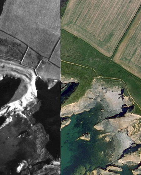
Remote sensing Porth y Rhaw 1946 –2006. Comparison by RCAHMW of 1946 and 2006 aerial photographs of the east side of Porth y Rhaw fort.
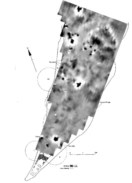
Remote sensing Porth y Rhaw geophysics. Geophysical Survey of the east site of Porth y Rhaw fort showing the sites of several roundhouses.
Contact: Ken Murphy
