Home > Historic Landscape Characterisation > Upland Ceredigion > |

 BANC BWA-DRAIN
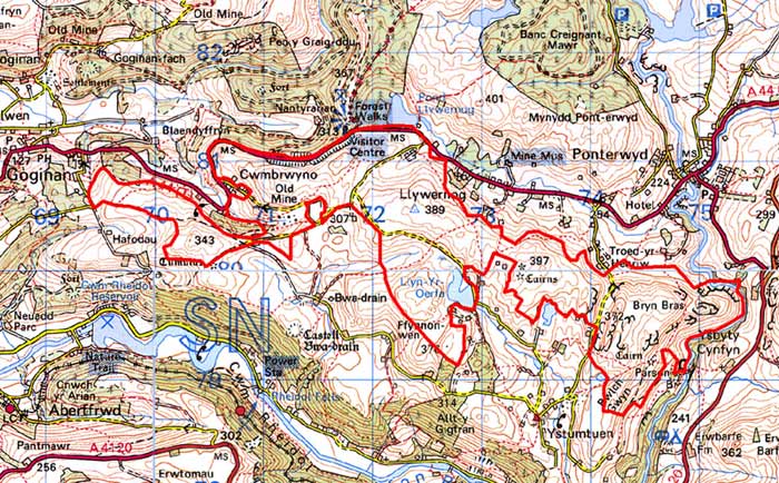
GRID REFERENCE: SN 723799
AREA IN HECTARES: 451.4
Historic Background
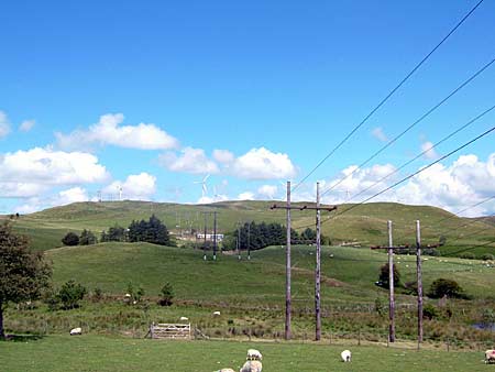
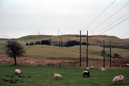
At least part of this area of high, unenclosed land lies within Cwm-hir Abbey’s Nantyrarian Grange, an important pastoral property in 1291 (Williams 1990, 40). By the 18th century, and probably earlier, most of the land in this area was the property of the Nanteos estate and/or the Gogerddan estate. Late 18th and early 19th century estate maps (NLW Vol 45, 21-22, 35; Vol 37, 57, 60) show it as unenclosed sheep-walk - it is unlikely that it has ever been anything other than marginal land and moorland - with what appear to be two or three squatter houses surrounded by small enclosures. These have now gone. Although Lewis Morris recorded lead ore in the mid 18th century, no attempt at mining seems to have been undertaken until the opening of the Cwmbrwyno mine in 1849. Reservoirs and leats were constructed and adits sunk. Production ceased in 1888 (Bick 1983, 19-20). A communications tower, wind-farm and electricity transforming plant have all been constructed in this area in recent years.
Description and essential historic landscape components
This is a high, craggy west - east aligned ridge, which achieves a maximum height of 389m. It is essentially unenclosed moorland with peaty hollows, although large enclosures formed by wire fences and some disused earth-bank boundaries of unknown date lie at the western end of the area where the ridge summit descends to c. 340m. Here there are pockets of improved grazing. The sites of abandoned cottages on the ridge summit at the western end and on the fringes of the area are inconspicuous, but are important elements of the historic landscape. The remains of lead mining at Cwmbrwyno are obvious historic landscape features. In 1999, a programme of environmental improvements was undertaken at Cwmbrwyno. The buildings and reservoirs at the site will remain following these works as testimony to this once important industry. At the eastern end of the area, peat-filled hollows may be evidence of more reservoirs constructed to serve lead mines to the south of this area. Much of the remote feel to this area has been destroyed by the construction of a wind-farm and power-lines, a communications tower and transforming station.
In addition to metal mine remains, the recorded archaeology consists of an abandoned settlement, probably of pre 19th century date and Bronze Age round barrows. The latter provide time-depth to this landscape.
This block of high, unenclosed land is well defined; lower lying enclosed land lies to the south, and to the north.
Base map reproduced from the OS map with the permission
of Ordnance Survey on behalf of The Controller of Her Majesty's Stationery
Office, © Crown Copyright 2001.
All rights reserved. Unauthorised reproduction infringes Crown Copyright
and may lead to prosecution or civil proceedings. Licence Number: GD272221