Home > Historic Landscape Characterisation > Upland Ceredigion > |

 CYNEINIOG
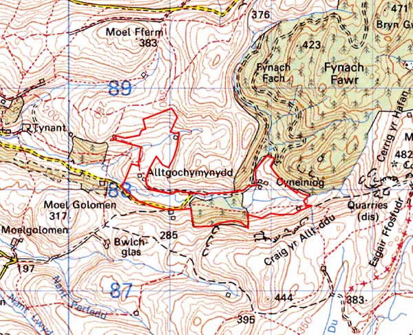
GRID REFERENCE: SN 719881
AREA IN HECTARES: 70.1
Historic Background
The history of this area has not been researched, and is therefore unknown. The only settlement in the area is Cyneiniog Farm with its associated field system. This farm was in existence by the early 19th century, and is perhaps likely to be of some antiquity. It is now separated from the lower Cyneiniog valley by forestry planted in the 1960s. Part of the plantation is included in this area. A short-lived railway/tramroad built in 1897 to serve the mines on high ground to the east passes through this area.
Description and essential historic landscape components
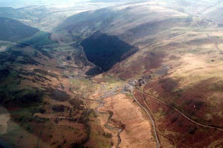
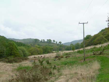
The upper Cyneiniog valley is steep sided and narrow. The valley floor is at 180m, with the valley sides rising to over 400m. Only the valley floor and gentle lower slopes are included in this area. Cutting across, but included in this area, and separating the valley to the east from that to the west, is a tract of 1960s coniferous plantation. To the west of the forestry the valley floor has been divided into small fields by boundary banks and walls. Some of these fields are overgrown and beginning to revert to rough pasture and moorland, although others are still used as hay meadows. Deciduous woodland of a very open nature, which has established itself on the lower slopes, lends a distinctive character to this area. The area to the east of the plantation, including Cyneiniog Farm, has not been examined on the ground. An embankment and other features of a railway/tramroad are components of the historic landscape.
The recorded archaeology comprises minor metal mines and a deserted post-Medieval settlement. All are located on the southern boundary of this area.
The boundary between this area and the Cyneiniog valley to the west is not at all well defined and should be regarded as a broad zone of change rather than a hard line. A steep valley side of open moorland provides a clear limit of demarcation to the south. Included in this area is modern forestry, of which the greater proportion has been assigned its own area.
Base map reproduced from the OS map with the permission
of Ordnance Survey on behalf of The Controller of Her Majesty's Stationery
Office, © Crown Copyright 2001.
All rights reserved. Unauthorised reproduction infringes Crown Copyright
and may lead to prosecution or civil proceedings. Licence Number: GD272221