
ABERGWILI
Click here for a copy of full the report
SUMMARY
Thomas Bek, Bishop of St Davids, founded a college and town at Abergwili in the late thirteenth century. The town was granted a weekly market and annual fair, but was small, with just 25 burgages recorded in 1326. These were laid out on either side of the High Street. St Davids Church lay on a lane to the south of the town and the college to the east end of the town. No archaeological work has been undertaken in the core of the medieval town.
KEY FACTS
Status: 1290 weekly market; 1313 annual fair.
Size: 1326 25 burgages.
Archaeology: no significant archaeological interventions.
LOCATION
Abergwili lies in Carmarthenshire at the confluence of the rivers Towy and Gwili a few metres above the flood plain (SN 439 210). High tides on both rivers extend just upstream of Abergwili. Carmarthen lies 2.5 km to the east. The Towy valley provides excellent route corridors to the west and east, and the Gwili valley gives access to north Carmarthenshire and beyond.
HISTORY
There is some evidence for a pre-Anglo-Norman church at Abergwili, but it is not until the 1280s that Abergwili enters history when Thomas Bek, Bishop of St Davids, founded a college. It is highly likely that he founded a small town at the same time to the west of the college, although no charter is known. In 1290 Abergwili was granted a weekly Friday market and in 1313 an annual fair. The town remained small; only 25 burgages were recorded in 1326. The later medieval history of the borough has not been researched.
St David’s Church, originally dedicated to St Maurice, was rebuilt in the 1840s immediately to the north of its medieval predecessor.
In 1541 the college was removed to Brecon and later in the sixteenth century the buildings were converted into a bishop’s palace. They remained as such until the 1970s when Carmarthenshire County Council acquired them for a museum. The diocese built a new bishop’s palace in the grounds of the old palace.
MORPHOLOGY

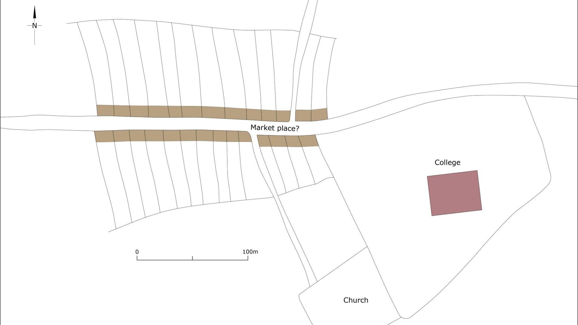
Map showing Abergwili as it may have been at its maximum extent in the medieval period, c.1320.
Until the twentieth century Abergwili consisted of one street, High Street (up until the late twentieth century this was the A40 trunk road), with the bishop’s palace at the east end and the parish church of St David’s on a side lane to the south. Long narrow properties shown on the 1840 parish tithe map and late nineteenth century Ordnance Survey maps on either side of High Street are remnants of burgages laid out in the late thirteenth/early fourteenth centuries. The 25 burgages recorded in 1326 could easily be accommodated in this area.
The Central Wales and Carmarthen Junction Railway was constructed to the north of Abergwili in the late nineteenth century and since the Second World War new houses have been built in and to the north and south of the historic core. The A40 now bypasses Abergwili, running along the line of the former railway.
