
FISHGUARD
Click here for a copy of the full report
SUMMARY

The origins of Fishguard are obscure but it was a relatively small and insignificant settlement until the seventieth and eighteenth centuries when it became the major town of north Pembrokeshire. There is no evidence for it having been a town in the medieval period. The only archaeological investigation in the historic core of Fishguard has been small-scale but revealed stratified deposits going back to the medieval period.
KEY FACTS
Status: village
Size: unknown
Archaeology: medieval archaeology was identified in an evaluation in the centre of Fishguard.
LOCATION
Fishguard lies on the north Pembrokeshire Coast (SN 958 370) above a good natural harbour. The historic core of Fishguard, the upper town, occupies high ground 70m above sea level. The lower town lies around a sheltered cove 0.5km to the west. The harbour at Goodwick, 1.8km to the north, is now commercial/industrial centre of Fishguard.
HISTORY
There are few sources and no published history of medieval and early modern Fishguard. By tradition the shadowy figure of Martin of Tours granted ‘Abergwaun’ along with other lands in what was to become the lordship of Cemais to Jordan de Cantington in the late eleventh century during the first wave of the Anglo-Norman conquest of southwest Wales. There is no historical evidence to support this tradition, but what is certain is that by 1115 Cemais was in the hands of the Anglo-Norman lord Robert Fitzmartin. The Fitzmartins established a castle in their lordship at Nevern, transferring it to Newport in the late twelfth century and also founding a town there. It is unlikely that the Fitzmartins would have tolerated a second town in Cemais to compete with their new town of Newport and therefore the existence of a sizeable settlement at Fishguard prior to the thirteenth century must be questioned. No medieval town charter is known and neither a market nor fair is recorded. The 1835 Municipal Corporations Commissioners referred to a 1653 survey which regarded Fishguard as a town and mentions burgages. In 1586 a portreeve was elected and later documents record burgesses. This evidence points to Fishguard being no more than a village in the medieval period, acquiring elevated status in the early modern period and becoming the chief town of north Pembrokeshire.
The parish church of St Mary’s was recorded in 1291 – the current building dates to 1855-57 and presumably occupies the site of the medieval church.
Eighteenth century references refer to an upper and lower town.
MORPHOLOGY

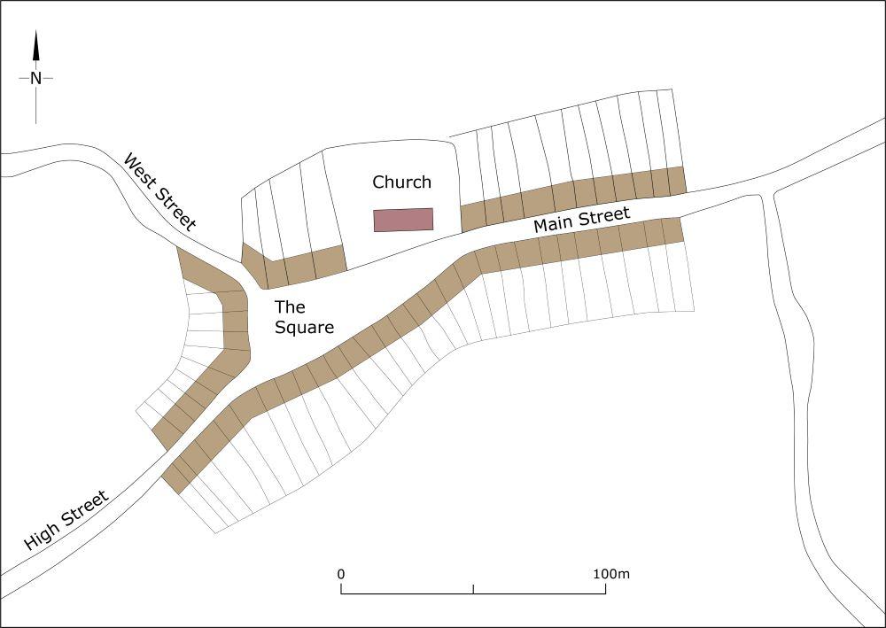
Map showing Fishguard as it may have been at its maximum extent in the medieval period, c.1320.
Due to the paucity of historical evidence, defining the character and extent of medieval Fishguard is problematic if not virtually impossible. It is reasonable to assume that the nineteenth-century St Mary’s Church occupies the site of the medieval church and that the street pattern shown on the 1843 tithe map in the vicinity of the church has been in existence for several centuries. These streets are: The Square, West Street, and High Street. The Square probably functioned as a village green/marketplace with houses clustered around it, but how many houses and how far they extended along the above named streets is unknown.
It has to be assumed that a settlement developed during the medieval period at what later became known as lower town around a good natural harbour.
During the nineteenth century both the upper and lower towns expanded and continued to do so in the twentieth and twenty-first centuries.
