
LLANELLI
Click here for a copy of the full report
SUMMARY
The medieval history of Llanelli is obscure. A church is recorded, St Elli’s, in the eleventh century, and it is assumed that a settlement developed around it following the Anglo-Norman conquest of the region in the early twelfth century. However, no markets or fairs are recorded, and it is only in the seventeenth century that documents refer to Llanelli as a borough. Whatever the status of medieval Llanelli, it would have been small with houses clustered around the church. However, the archaeological potential of Llanelli was demonstrated by investigations during the restoration of Llanelly House, which revealed stratified archaeological deposits going back to at least the Tudor period.
KEY FACTS
Status: Llanelli was not a town in the medieval period.
Size: Unknown, but small.
Archaeology: Work in Llanelly House revealed post-medieval archaeology.
LOCATION
The historic settlement of Llanelli lies on the north side of the River Leidi in southeast Carmarthenshire where the river meanders across a wide coastal plain (SN 506 005). The centre of the town is now 1.3 km from the sea, but in the medieval period the Lledi may have been a tidal inlet as far inland as Llanelli’s historic core.
HISTORY
Nineteenth and twentieth century industry dominate the history of Llanelli and obscure, both historically and physically, its origins in the medieval period.
There is a late eleventh century reference to St Elli’s church in the Book of Llandaff, but nothing is known of an associated settlement, if indeed there was one. The Anglo-Normans established a castle at Carnwyllion, probably in the early twelfth century, during their conquest of the region. Carnwyllion Castle was established on a site known as ‘Old Castle’, 700m to the west of St Elli’s parish church and now mostly submerged by the waters of a reservoir. The first record of the castle was in 1190 when it was destroyed by the Welsh. It was destroyed again in 1215. The castle drops out of history at this date. There is no known medieval history of Llanelli; it was not granted a town charter and no known grants of rights to hold a market or fair are known.
In the 1530s the antiquary John Leland called it ‘a village’ and a 1609-13 survey records 59 freeholders in the borough of Llanelli. Later documents also refer to Llanelli as a borough, but as late as the early nineteenth century only 51 houses were recorded. From the mid-nineteenth century onwards Llanelli rapidly expanded.
MORPHOLOGY
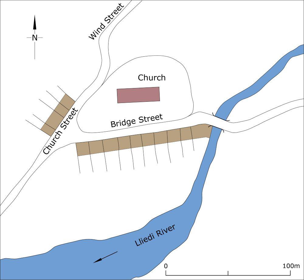
Eighteenth and early nineteenth century maps show approximately 50 houses clustered around St Elli’s churchyard On these maps houses are shown on Church Street, Bridge Street, Thomas Street and Wind Street, all on the north side of the meandering River Lledi (this is now culverted). The substantial Llanelly House is shown immediately to the south of the churchyard with substantial gardens to its south.

Schematic plan of Llanelli as it may have been in the early fourteenth century.
It is assumed that the medieval settlement occupied a similar location to the houses shown on eighteenth and nineteenth century maps, but was probably not so large. However, its exact location remains unclear.
The large churchyard, 125m east/west and 70m north/south has retained much of its size and shape since the first map depiction of it in the mid-eighteenth century, although it may have once extended further to the southeast as human bones have been discovered close to Falcon Bridge. Twentieth-century road-widening and car park construction to the north and west of the churchyard required the demolition of houses and other buildings and with them evidence of medieval and later archaeological deposits, if indeed there were any at these locations.
